The Complete Guide to Hiking Taiwan's Southern Three Stars Part 2: Discover Guanshanlingshan
Continue your adventure with part two of Taiwan's esteemed Southern Three Stars, featuring the serene charm of
Mt. Guanshanling. This enticing hike on the Southern Cross-island Highway promises panoramic scenery from the
stunning Guanshan Mountain Pass (Yakou) and Mt. Siangyang. Revel in the breathtaking views as you traverse
through Taiwan's majestic landscapes.

This post includes information on accommodations, permit applications, and traffic guidelines, ensuring a
seamless high-mountain experience with the convenience of a day hike.

Disclaimer:
All content is for inspiration only. Use Taiwan Hikes' suggestions at your own risk. We are not responsible for any losses, injuries, or damages.
Taiwan Hikes may include affiliate links. When you purchase through these links, you support our ability to continue providing FREE content — at no additional cost to you.
Table of Contents:
- Trail Information: Mt. Guanshanling (Guanshanling Mountain)
- Accommodations, Transport to the Trailhead, and Map/GPX Data
- Permit Applications and Southern Cross-island Highway Traffic Control
- Itinerary of Mt. Guanshanling Hike
- About Mt. Guanshanling, Guanshan Mountain Pass, South Cross-island Highway, and Three Stars
- Free Guides: How to Apply for Hiking Permits in Taiwan. Or Hire Me!
- Related Posts
Exploring Taiwan? Save Time with the Ultimate 2026 Hiking Guide! Discover the top hikes in every city and
county across Taiwan—all accessible by public transport (bus links available). We've spent 35+ hours
researching the best trails and transit options, so you can skip the hassle and start your adventure!

Trail Information: Mt. Taguan (Taguanshan) of Nanheng Highway Three Stars
Trail Name: Mt. Guanshanling (Guanshanlingshan) 關山嶺山, listed as No. 77 in the
100 Peaks in Taiwan. Nanheng Highway is short for the Southern Cross-island Highway.
Distance: 3 km (2.75 miles)
Route type: Out-and-back
Days/Hours Needed: 3-4 hours
Total Ascent/Descent: 447 m/447 m
Best Time to Go: All seasons, but winter is also the snow season. Yushan National Park will ask for hikers to declare the snow season form.
Permits: A police mountain entry permit is required.
Difficulty Level:
Peaks or Places to Reach
- Mt. Guanshanling, or Guanshanling Mountain 關山嶺山, 3,176 meters (10,420 feet) above sea level. There's a Class 2 Triangulation Stone on the top. You can see Mt. Siangyang and other high mountains on the top.
Accommodations, Transport to the Trailhead, and Map/GPX Data
Hotels, Campsites, and Restaurants on the Kaohsiung/West Side
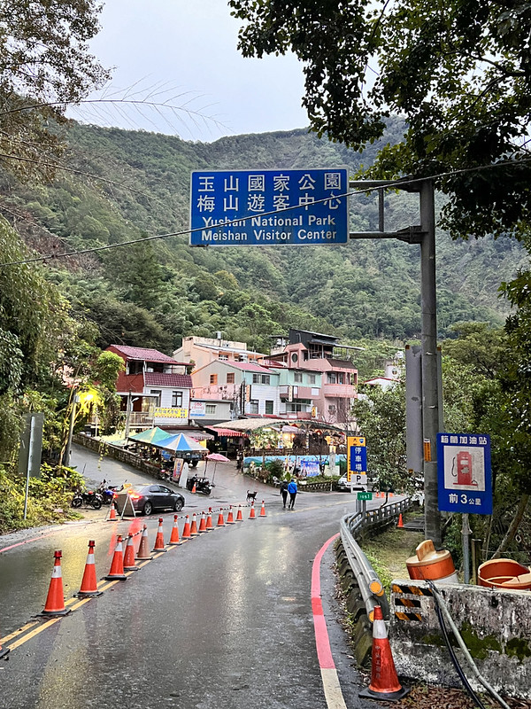
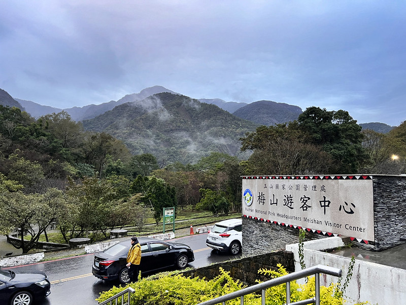
There are several hotels, B&Bs, and campsites near the Meishan Visitor Center 梅山遊客中心.
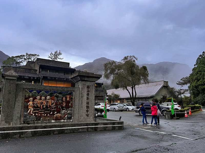
Meishan Youth Activity Center 梅山青年活動中心 is another option.
If you stay here overnight, you can save driving time to the trailhead, which takes around one hour.
Hotels, Campsites, and Restaurants on the Taitung/East Side: Siangyang Checkpoint
The closest hotels near Siangyang Checkpoint are in of Lidao Village Haiduan Township,
Taitung, or Motian Farm. It takes around 1 hour from Lidao Village to the Meishan
Checkpoint.

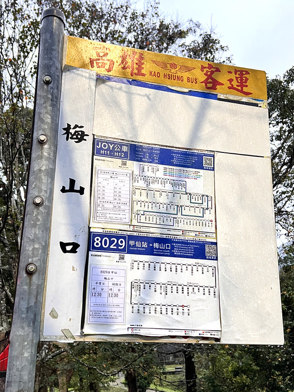
The West Side: Transport from Jiasian, Kaohsiung to Meishankou
Kaohsiung Bus 8029 goes from Jiasian Station 甲仙車站 to Meishan
Village at 9:00 and from Meishan Village Stop at 12:25. It takes around 1.5 hours from Jiasian Station to
Meishankou Stop (Or Meishan Mouth) 梅山口.
The bus stop is close to the Meishan Checkpoint of Southern Cross-island Highway
南橫公路西端梅山管制站.
Kaohsiung Joy Bus H11 Shuttle goes from Liugui 六龜 to Meishankou but the bus ride is long. Bus 8029 is faster.
The East Side: Transport from Siangyang Checkpoint of Southern Cross-island Highway 向陽管制站
There is no public transport to Siangyang Checkpoint.
Transport from Meishan Checkpoint of Southern Cross-island Highway to Mt. Taguan Trailhead
There is no public transport to the trailhead, either. Most people hire the private pickup service from
Kaohsiung. The cost is around NT$5,000-6,000 per day.
If you drive or ride a scooter, the parking area near the trailhead is at 33.5 km signage.
GPX Track
Route map for Mt. Guanshanling-updated by Anusha Lee on plotaroute.com
Click Menu in the map to download, print, or share the map.
You can see more options after clicking the Play button.
Click to change the speed to meet your condition.
You can see more options after clicking the Play button.
Click
to change the speed to meet your condition.
Permit Applications and Southern Cross-island Highway Traffic Control
How to Apply for Police Mountain Entry Permits
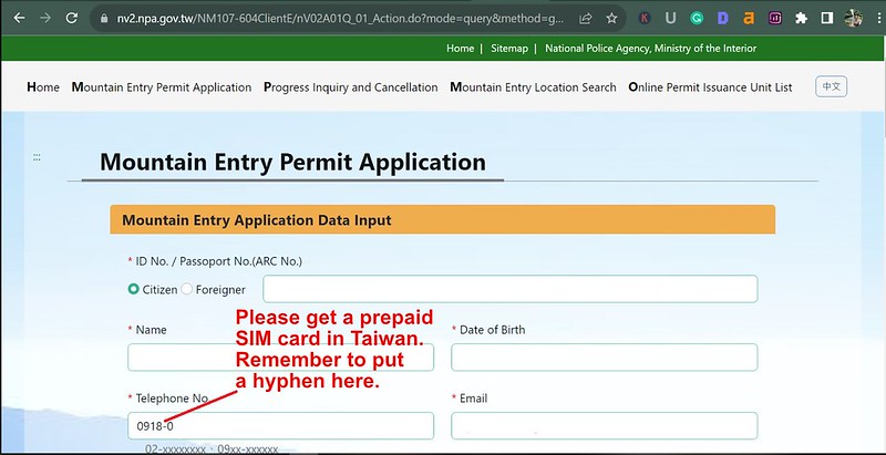
Go to the National Police Agency's Mountain Entry Application System. Tick the box, put
your ID/Passport number, put the correct verification code, and click "Submit". You will see the following page.

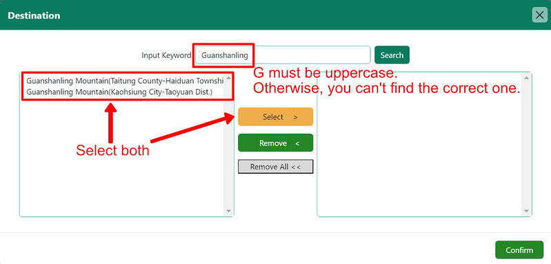
In the "Plan" area, put "Guanshanlingshan Trailhead ➔ Mt. Guanshanling ➔ Guanshanlingshan
Trailhead."
Click "Roster" to fill out the form if you have other hiking partners. Then, click "Submit".
Traffic Control from Meishankou to Siangyang on Provincial Highway 20 of Southern Cross-island Highway
Check Yushan National Park's website for English information about traffic control. Click "Highway Traffic Control."
Or check Provincial Highway Real Time Information Service for the latest traffc control.
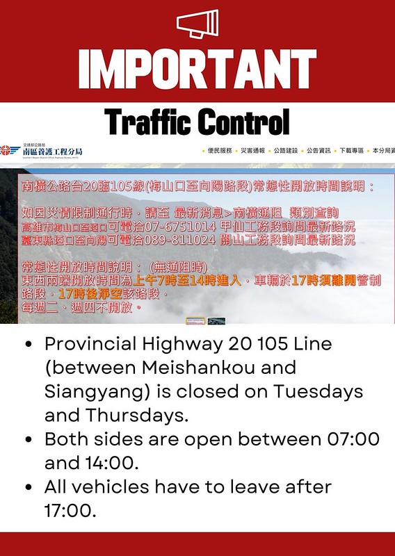
The section from Meishankou to Siangyang is closed on Tuesdays and Thursdays. Vehicles are allowed to enter from
both sides from 07:00 to 14:00. All vehicles must leave before 17:00. Vehicles with license plates are allowed
to enter. Bicycles are not allowed in this section.
When the highway becomes icy because of the cold weather, the Southern Region Branch Office of the Highway
Bureau will close the sections, too. Please check the Southern Region Branch Office's website
for details (only available in Chinese.)
Or call for the latest news: +886-7-6751014 on the Meishankou to Yakou side in Kaohsiung (高雄市梅山口至埡口), or +886-89-811024 on the Yakou to
Siangyang side (臺東縣埡口至向陽) in Taitung.
Itinerary of Mt. Guanshanling Hike
Brief itinerary: Trailhead to Mt. Guanshanling ➔ Mt. Guanshanling ➔ Trailhead to Mt.
Guanshanling
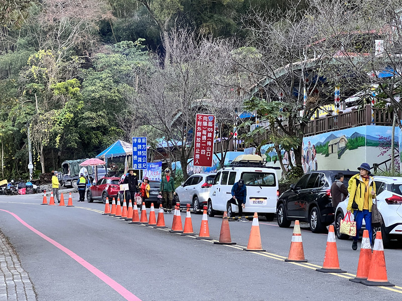
Passed the Meishankou Checkpoint. I did this hike after we finished Mt. Taguan, so we were slightly rushed to leave the highway
because of the traffic control.
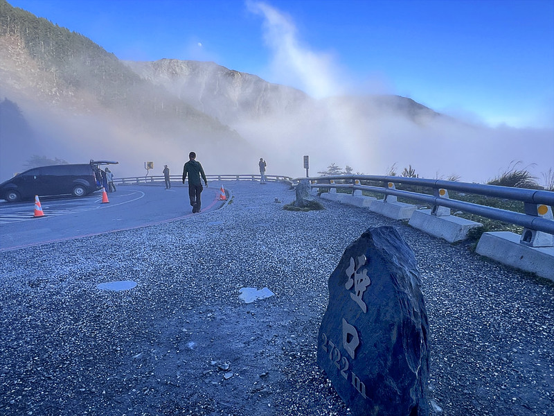
12:56 We reached Daguanshan Tunnel 大關山隧道 and Guanshan Yakou (Guanshan Mountain
Pass) 關山啞口. When we got there, the clouds had covered everything up. You can tell this is a popular tourist spot
by the size of the crowd.

13:01 We walked to the trailhead, on the top of the tunnel, and embraced the
steep scramble slope. This section was almost vertical, and the loose scramble made ascending more difficult.


After climbing up for a while, I could still hear the loud noise from the mountain pass.

The weather became tricky. There was blue sky and sunshine, but the clouds played a seek and hide game with
them. I wasn't sure whether our good luck that morning would continue to promise a good view later. Yet, the
west side looked wonderful.

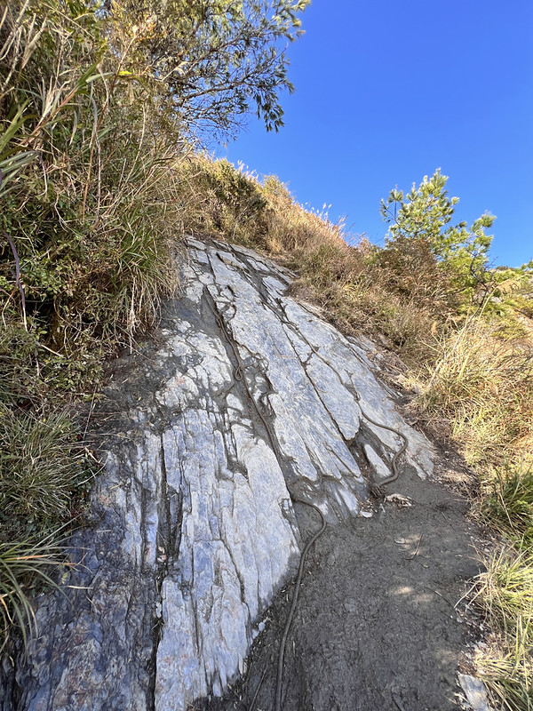
13:32 We reached a steep rock slope. There were ropes on the side, but getting
up still took me a while.
After climbing, the 0.5 km signage appeared with a bright blue sky in the back.
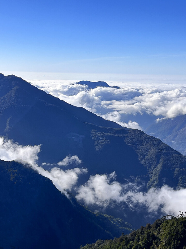
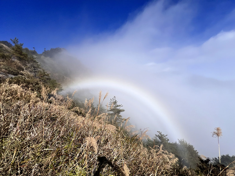
On the Guanshan Mountain Pass side, I saw the sea of clouds and rainbow! I have countless times when the
overcast at the beginning of the hikes turned into one of the most gorgeous seas of clouds I've ever seen. Is
this going to be another one?
The excitement of the possibility of breathtaking views was quickly replaced by the taxing ascending. There was
almost no easy section here for me to catch my breath.
Yet, the thick clouds were underneath our feet, and I felt mist on my face, which explains why we had rainbow.
14:07 I passed the signage of 1 km. I still had 500 meters to go. It feels more
like 5 km to me at that moment.
When I stopped to catch my breath and looked back, the mountains behind me were like a solid wall, circling all
the clouds on the east side. Only a few streams of mischievous clouds got a chance to escape the hold and flew
over the rugged ridge.
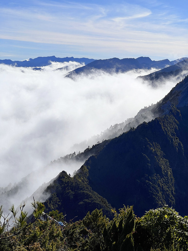
Moreover, a big lenticular cloud formed on the top of the most pointed peaks and looked like a UFO. I wish to
sit here to enjoy the view without going to the peak, but we still have to continue.

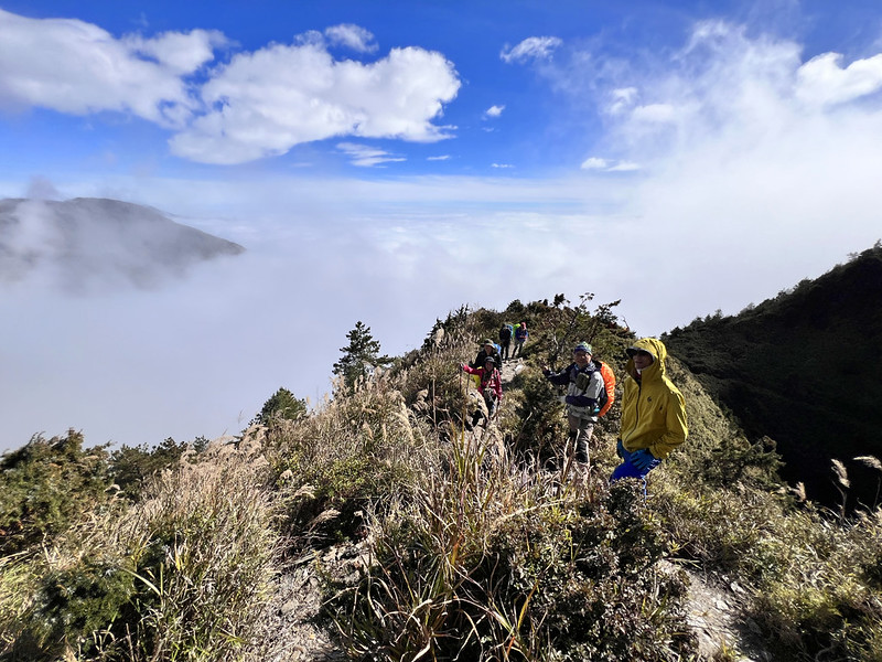
Now, I could see a milder slope with hikers scaling up in front of me. This section indeed felt like 5 km to me.

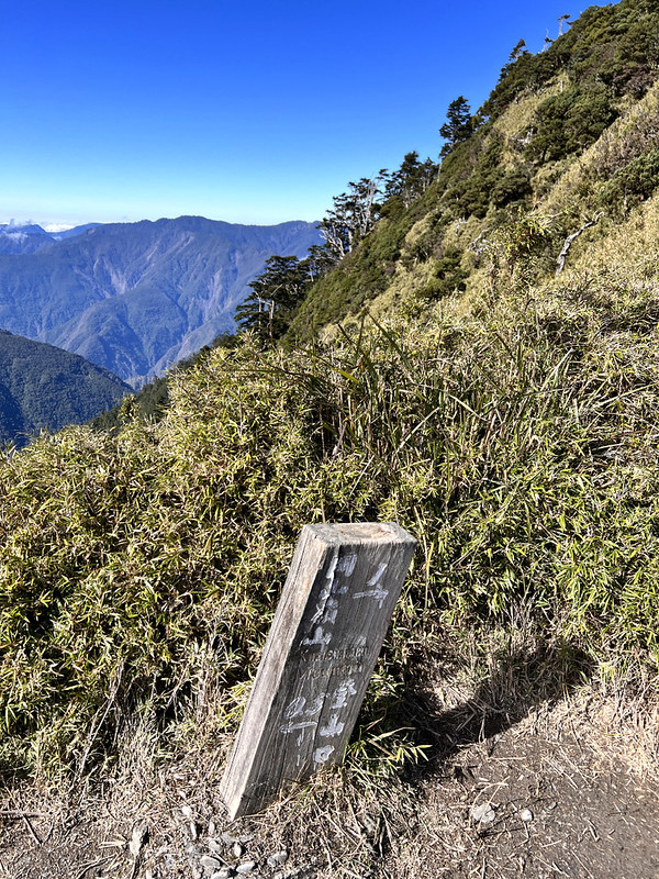
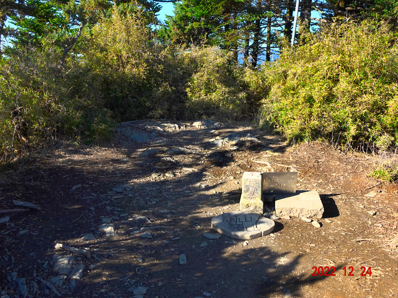
14:42 Finally, I reached Mt. Guanshanling, 3,176 meters. There wasn't an ample
space on the top, and I suddenly heard someone calling my name.
It was my French hiking mate! We did the Taipingshan and Jialuo Lake hike (post coming soon) together in October
2023. He was hiking with his family and friends. What a great surprise.

If you continue the hike, you will eventually reach Mt. Siangyang and even Jiaming Lake. But this is a much more
challenging hike, not for everyone.

While the spectacular views were worth staying longer, the pressure to leave the Southern Cross-island Highway
still lingered. I still managed to shoot a time-lapse video and rushed as fast as possible to return to the
trailhead.
On the way back, the big lenticular cloud was out of shape. Perhaps the extraterrestrial object had finished its
abduction mission and took off.
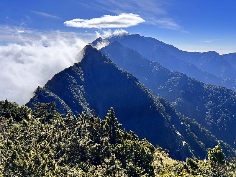
The rainbow was still there waiting for us.

16:04 I returned to the trailhead. Now, the crowds and clouds were half gone,
and I could see why Yakou (Guanshan Mountain Pass) had attracted so many people.

About Mt. Guanshanling, Guanshan Mountain Pass, and Southern Cross-island Highway and Three Stars
The Guanshan Historic Trail and the Southern Cross-island Highway (Provincial Highway 20) 台20線
The Guanshan Historic Trail was built during the Japanese
colonial period as a road for coercing the indigenous people. It starts in the Liugui District of Kaohsiung City
高雄市六龜區 in the west, crosses the Central Mountain Range, and ends in Guanshan Town, Taitung County 臺東縣關山鎮 in the
east, spanning approximately 171 km, making it the longest ancient trail in Taiwan.
After World War II, the Taiwan Provincial Government used this ancient trail as a prototype to construct the
Southern Cross-island Highway. As a result, most of the original trail has disappeared.
The most famous remaining section is the Zhongzhiguan Historic Trail between Zhongzhiguan and Tianchi. It took
three years to rebuild the Zhongzhiguan Historic Trail, and finally opened in 1997.
Now, the Southern Cross-island Highway starts from Yujing Township, Tainan County 台南縣玉井鄉 in the west, crosses
the Central Mountain Range through Kaohsiung City, and ends in Haiduan Township, Taitung County 台東縣海端鄉 in the
east.
It is the shortest of the three highways that traverse the Central Mountain Range in Taiwan and is commonly
known as Provincial Highway 20 台20線. The entire Southern Cross-island Highway is divided into eastern and
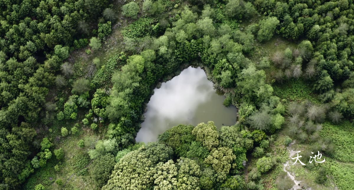
western sections by Tianchi/Tian Pond 天池.
The western section is characterized by its reservoirs, mountain villages, hot springs, valleys, and mountainous
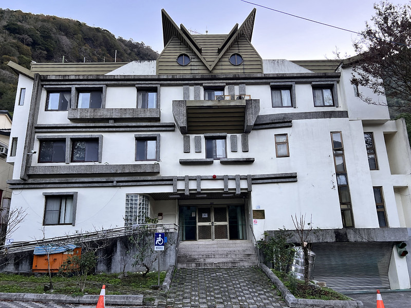
landscapes. Meishankou is one of the prime sections, featuring the Yushan National Park Meishan Visitor Center,
Meishan Native Plant Garden, Bunun Exhibition Hall, Meishan Police Station with its owl-shaped exterior, Meishan
Camping Area, and Meishan Youth Activity Center.
Meishankou/Meishan Visitor Center is the gateway to the Yushan National Park and the only service station on the
Southern Cross-island Highway. The visitor center is mixed with the Bunan's slate house style. It's being
renovated and will be open to the public again after April 2024.
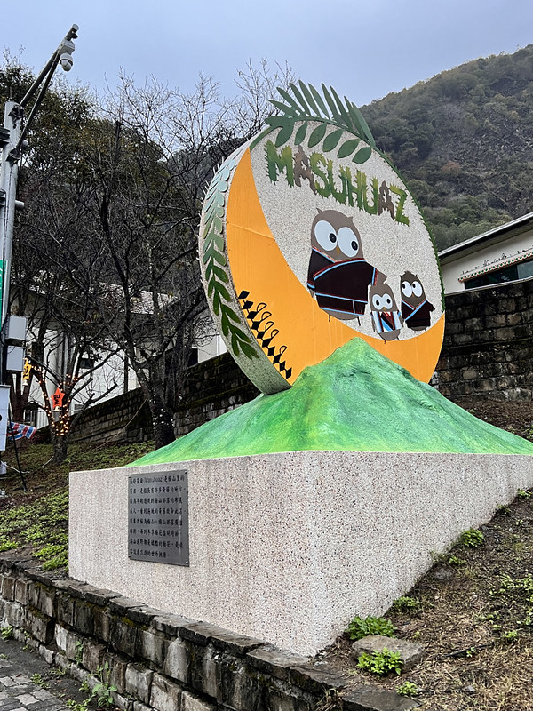
The Meishan tribe is located in the northernmost part of Taoyuan, Kaohsiung City, on a high river terrace of the
old Laonong River channel. The area was initially covered with Yellow Rotang Palm, known in the Bunun language
as "Masuhuaz," the tribe's old name.
Today, it's divided into Meishan Entrance (Meishankou) and Meishan Tribe. Meishankou, at the foothills along
Provincial Highway 20, serves as a commercial hub for locals and tourists. The Meishan Tribe can be accessed via
a connecting road from Meishankou. Now, Meishan (meaning plum mountain in Chinese) is famous for the plum
blossoms in winter.
The section from Siangyang to Guanshan Yakou (mountain pass) 關山埡口 is the most spectacular part of the Taitung
section of the Southern Cross-island Highway. The landscape of cliffs and gorges is magnificent, complemented by
forests and high mountains. The Southern Cross-island Highway is in a tropical zone, and due to its high
altitude, it offers a cool climate all year round and the unique sight of red leaves typically found in cold and
temperate zones.
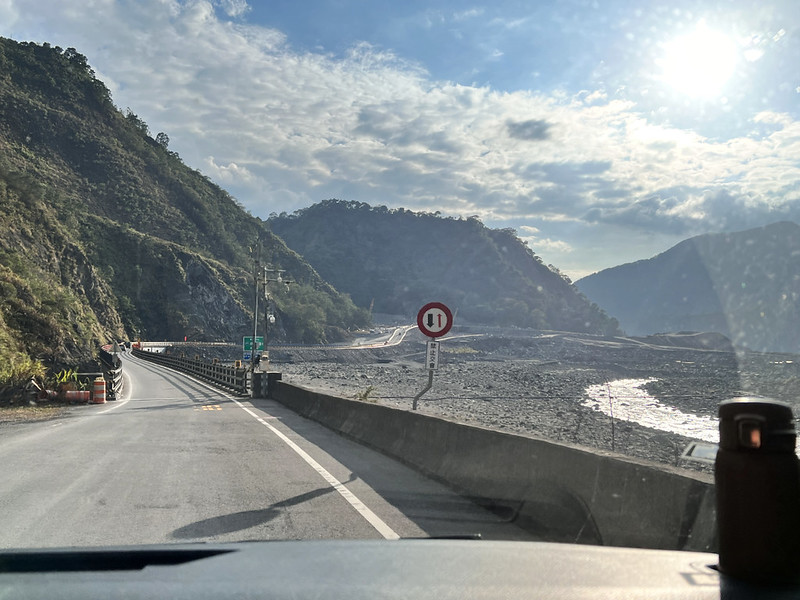
The Devastation Brought by Typhoon Morakot 莫拉克颱風
Typhoon Morakot, hitting Taiwan in August 2009, is one of the deadliest typhoons
in Taiwan's recorded history. It brought unprecedented torrential rains, triggering catastrophic landslides and
widespread flooding across the region. The storm resulted in over 600 fatalities, causing roughly NT$110 billion
(US$3.3 billion) in damages, with the village of Xiaolin 小林村 being almost entirely eradicated.
- August 8, 2009: Due to Typhoon Morakot, multiple sections of Provincial Highway 20 collapsed or were disrupted, which led to those sections being closed.
- January 12, 2020: Provincial Highway 20 was open eastbound to 105K (Meishan Entrance) and westbound to 149K (Xiangyang).
- January 13, 2020: The section from Meishan Entrance to Tianchi was conditionally opened for traffic.
- August 7, 2021: The Mingbakelu Bridge 明霸克露橋 was destroyed by floods due to the effects of the mild Typhoon Lupit.
- May 1, 2022, 7 AM: After nearly 13 years of closure, the Provincial Highway 20 was reopened with traffic controls and closures on Tuesdays and Thursdays.
Mt. Guanshanling and Guanshan Mountain Pass
Mt. Guanshanling or Guanshanling Mountain 關山嶺山, 3,176 meters, is a renowned peak on the southern main ridge of
Taiwan's Central Mountain Range, ranking 77th among Taiwan's 100 Mountains. Straddling Taitung's Haiduan
Township and Kaohsiung's Taoyuan District, it lies on the southwest border of Yushan National Park. It is the
second star of the Southern Cross-Island Highway's 'Southern 3 Stars'.
The Guanshan Tunnel 關山大隧道, part of the scenic Southern Cross-Island Highway, offers breathtaking views of
majestic mountains and dense forests. This tunnel, at 2,722 meters, also Taiwan's highest tunnel, divides the
island's east and west, showcasing distinct landscapes and climates.
The tunnel's eastern entrance in Taitung is known for its stunning sea of clouds in the afternoon, formed around
2,500 meters due to monsoonal moisture and terrain.

Other Attractions on the Southern Cross-island Highway
Even if you don't do hikes, Southern Cross-island Highway is a breathtaking highway that worth visiting. After
we finished the hike, we saw the clouds floating around the valley and I wished we could just stop for a moment
to savor the amazing views.
Those are the stops that you should go if you come here:
- Xinliguan Observation Deck 新禮觀觀景台. You will find toilets here.
- Tianchi (Tian Pond) 天池 and Zhongzhiguan Historic Trail 中之關步道. Tianchi is an alpine lake in Taoyuan, Kaohsiung, with an elevation of 2,280 meters. Situated behind the Changqing Temple on the Southern Cross-island Highway, Tianchi has a heart-shaped appearance. The lake's water source relies on rainfall and melting snow, with an average depth of 1.2 meters and an area of about 1,800 square meters.
- Changchun Shrine 長春祠, built in 1979, was to honor the 116 engineers and workers who tragically lost their lives during the construction of the Southern Cross-island Highway.
For the stunning views here, please see Yushan National Park's video about the Southern Cross-island Highway. Or click the image below.
Get Free Guides on Public Transport and Applying for Permits. Or Hire Me!
Free Bus Guides to Hike Popular Mountains in Taiwan
Taking buses to hike in Taiwan can be tricky if you don't read Chinese. Therefore, I've made several public transport guides to help you get to the trailheads. Or click the
image below to see more details.