Striking Pitons and Crags in Pingxi: Shizhu Piton and More
If you are looking for hiking trails with striking landscapes near Taipei, this hike is for you. There are many famous trails like Xiaozi Crag, Cimu Peak, and Zhongyang Piton. In this post, you will see the less known Shizhu Piton, but the hike is more challenging. The reward is the amazing views along the ridge.


Table of Contents:
- About Pingxi, the Railway and Famous Hiking Trails
- About Sky Lanterns Issues
- How to Get There
- Peaks and Places to Reach
- A Supposed Easy Hike Ended up as A Challenging One: Shizhu Piton
- Mt. Jiulong and Exciting Wumingjian
- More Challenging Hike Awaited Which Made Me Regret
- The Relaxing Dongshige Yueling Historic Trail with Tranquil Creek
- Thoughts about This Trail and Other Routes to Enjoy Pingxi
- Map and Itinerary
- Recommended Blogs and Resources
- Related Posts on Taiwan Hikes
Exploring Taiwan? Save Time with the Ultimate 2025 Hiking Guide! Discover the top hikes in every city and county across Taiwan—all accessible by public transport (bus links available). We've spent 50+ hours researching the best trails and transit options, so you can skip the hassle and start your adventure!

About Pingxi, the Railway and Famous Hiking Trails
If you Google Pingxi, you'll find tons of information and tourist attractions about this place, and here is a Guide to the Pingxi Railway 平溪支線鐵路懶人包 from Foreigners in Taiwan.

If you want to know where you can hike in Pingxi, Taiwan Trails and Tales has several great posts like ZHONGYANG PITON and CHOU TOU SHAN (中央尖/臭頭山), PINGXI CRAGS (平溪小三尖) and more.

I did a hike to Mt. Xiaozi 孝子山 and Cimu Peak 慈母峰 in 2017 and I highly recommend those ridgeline hikes if you are okay with height.

The altitude of Pingxi is around 500 meters above the sea level, but the terrain is cragged and treacherous. There is a Chinese saying that is often used to describe Pingxi's landscape, Di Wu San Li Ping 地無三里平, literally meaning you can't find a big, flat area.
As a result, there are many peaks or mountains called crag or piton 尖 in this small hillside town. Hikers pick up three of those crags and call them Pingxi 3 Crags 平溪三尖: Shulangjian 薯榔尖 (or Shulang Peak, 622 meters), Shisunjian 石筍尖 (or Shisun Peak, 609 meters, meaning stone bamboo shoot), and Fengtoujian 峰頭尖 (520 meters). In fact, there are many other mountains are also named crag or piton like Mt. Xiaozi (or Hsiaotz Mountain on the mas), Zhongyang Piton, etc.

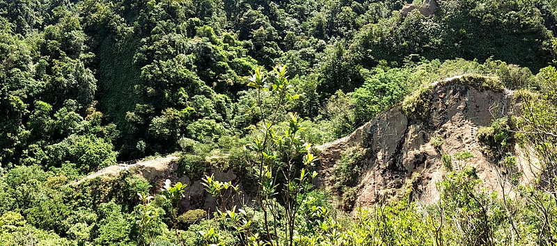
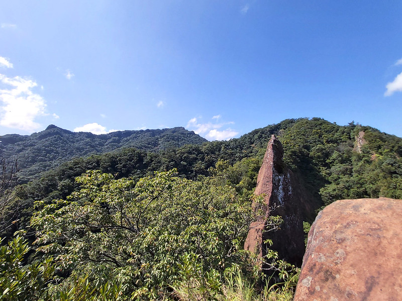
Shizhu Piton, literally meaning Stone Candle Piton in Chinese, is actually not a peak that can be reached, but rather a sharp rock protruding into the sky. Hikers climb to the rock next to it to admire this striking geological formation. It does look like a candle or even a dagger when you hike underneath it.
Dongshige Yueling Historic Trail 東勢格越嶺古道
Hiking Dongshige Yueling Historic Trail 東勢格越嶺古道 was my Plan A on that day. According to a famous Taiwanese hiker Tony Huang, Dongshige Yueling Historic Trail was an old road between two villages in Pingxi. After the coal mining was booming, miners also took this route to Pingxi downtown.
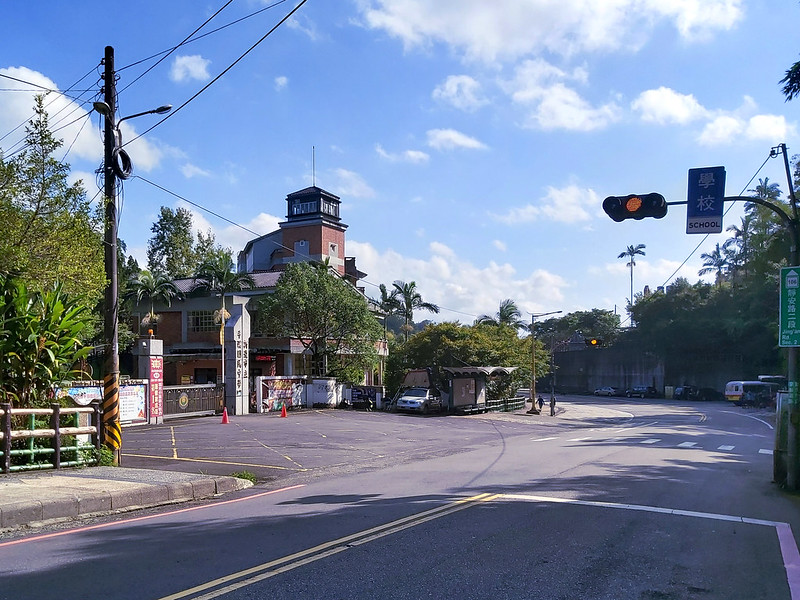
There are two trailheads to Dongshige Yueling Historic Trail, but the most popular one is through the one close to Pingxi Junior High School. You will see the relics, an old tram, offices left from the mining industry along Gualiaokeng Creek 瓜寮坑溪. It's very relaxing to hike on this trail or just sit by the creek listening to the flow. Highly recommended.
About Sky Lantern Issues
Another thing about Pingxi is the famous sky lantern festival. You will find many stories and pictures about this festival, but I'll not elaborate more here. On the contrary, there are several issues caused by sky lanterns. Taiwan Trails and Tales also has a post, PINGXI SKY LANTERNS (平溪天燈), dedicated to the aftermath of releasing sky lanterns. Please take some time to read them before you decide to do sky lanterns when you visit Pingxi.

How to Get There
By Train
You can take the famous Pingxi Line and get off at Pingxi Railway Station and walk toward to Pingxi Junior High School to the trailhead. Those trails are mostly well marked, and it's easy to find your way to the trail.
By Bus
Or you can take Taipei MRT and get off at Muzha Station, and transfer to Bus 795 and get off at Pingxi Junior High School Stop.
Peaks and Places to Reach
Shizhu Piton: 石燭尖, 420 meters (1,378 feet).
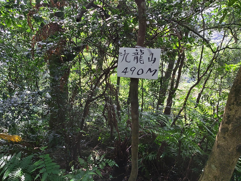
Mt. Jiulong: 九龍山, 490 meters (1,608 feet).
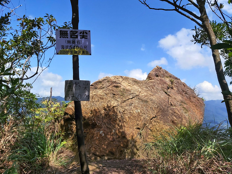
Wumingjian: 無名尖, 540 meters (1,772 feet).
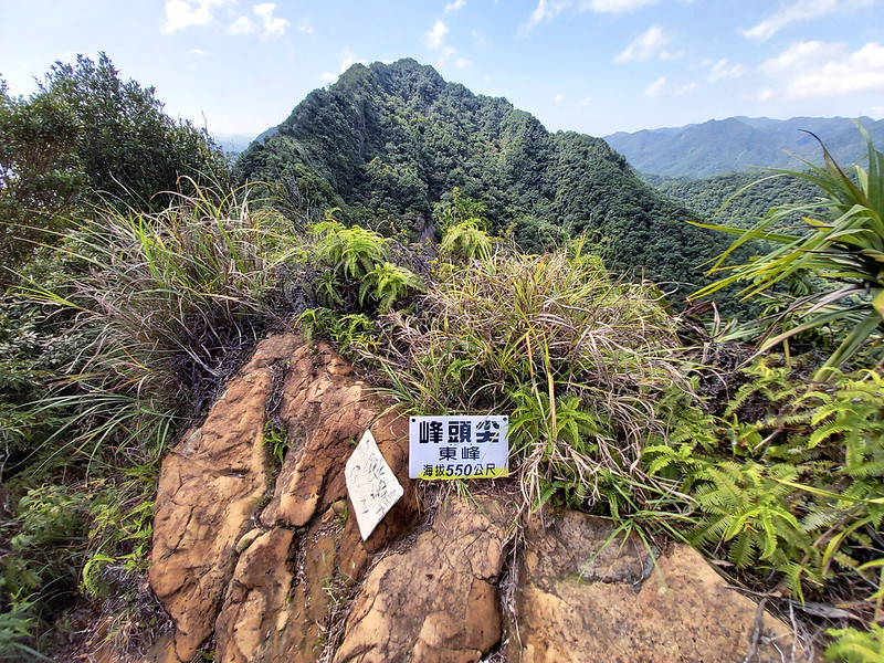
Fengtoujian East Peak: 峰頭尖東峰, 550 meters (1,804 feet).
Mt. Jiulong: 九龍山, 490 meters (1,608 feet).
Wumingjian: 無名尖, 540 meters (1,772 feet).
Fengtoujian East Peak: 峰頭尖東峰, 550 meters (1,804 feet).
A Supposed Easy Hike Ended up as A Challenging One: Shizhu Piton
Distance: 4.6 km (2.9 miles)
Brief itinerary: Pingxi Junior High School (height 224 meters) ➔ Shizhu Piton (height 420 meters) ➔ Mt. Jiulong (height 490 meters) ➔ Wumingjian (height 540 meters) ➔ Fengtoujian East Peak (height 550 meters) ➔ Pingxi Junior High School (height 224 meters)
GPS coordinates of trailhead: 25.023229, 121.732993
I thought this would be a very relaxing hike to enjoy the beautiful autumn day, but I took a wrong turn and I ended up a different route, a much more difficult one. Kids, don't do this at home.
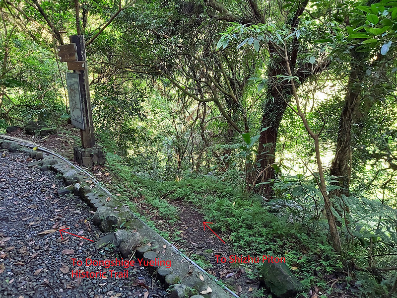
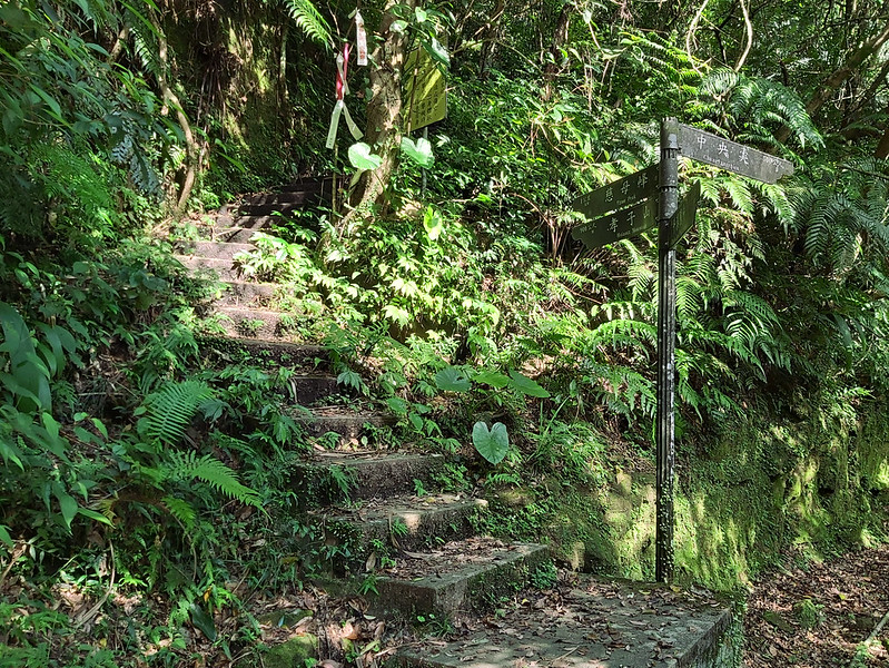
After getting off at Pingxi Junior High School Stop, I went across the road to the trailhead. You will find a map written in Chinese and English there.
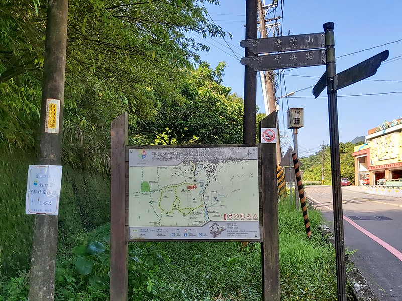
Within a few minutes, I reached the first junction pointing to Cimu Peak, Shizhu Piton, and Donshigenon Rd. 東勢格農路. If you want to hike Shizhu Piton, you can turn right here or later like what I accidentally did. Some hikers said they passed some residential houses when hiking to Shizhu Piton, but I didn't see those houses. I think that is because they made a turn right here.

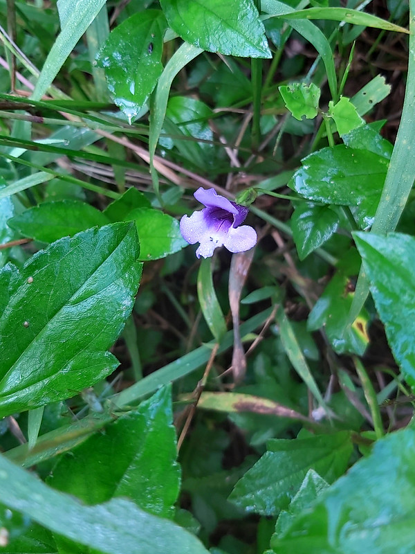
I took the one to Dongshigenon Rd. and got caught up with the beautiful wildflowers for a while.
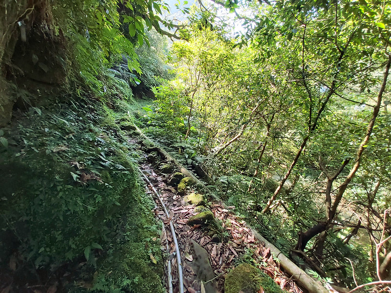
Then I continued to hike up and reached a cart track left behind by the mining industry. When I stopped to check the map on the side of the trail, I saw a trail going down.

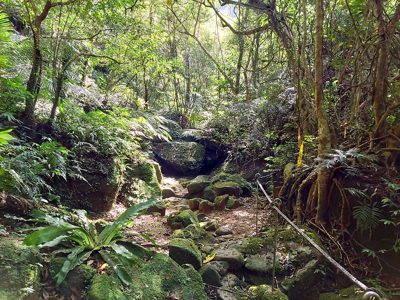
The trail going down wasn't like the ones made by the local government, and it was more like walked by hikers.
I was drawn by this one, and I thought I was on the right track according to my GPS (actually, it wasn't). The detour trail condition wasn't too bad, but there were several big water hoses which made it not easy to walk.
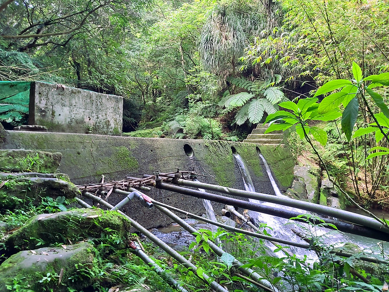
I ended up to a check dam called Gualiaokeng Check Dam 瓜寮坑攔砂壩.
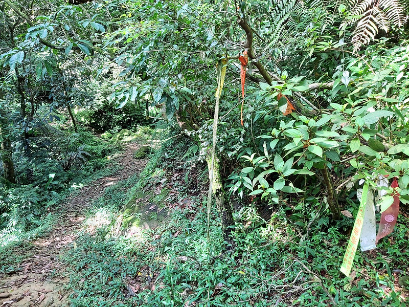
After passing the dam, I saw a junction. I still didn't realize I took the wrong turn way earlier before the dam, and I came back and forth trying to navigate my way. Those ribbons left by other hiking groups didn't help me, either.
I decided to take the trail up after several futile attempts, since I got an offline map with me. I usually followed my planned routes and I admit I became bolder after doing several solo hikes. Again, kids, don't do this at home.
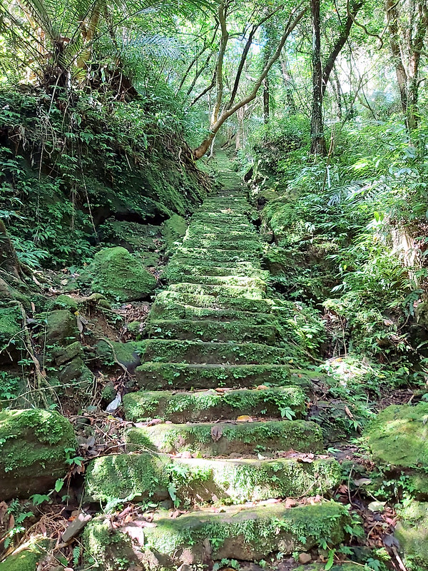
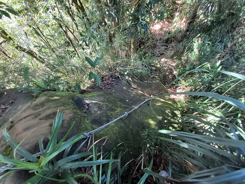
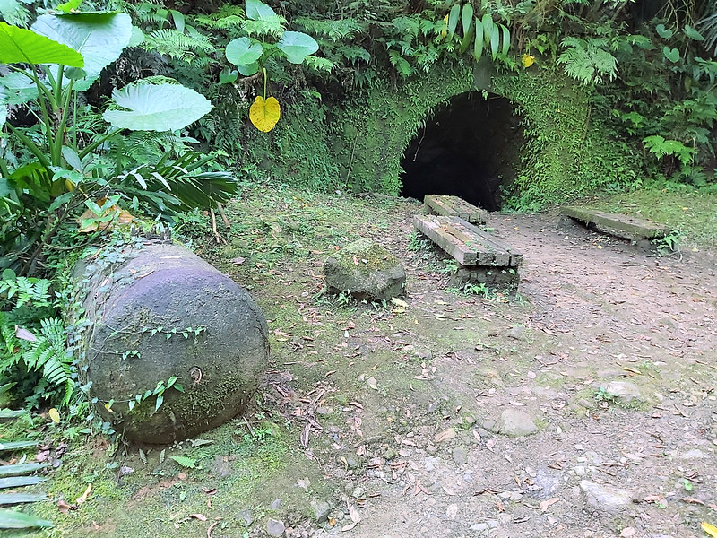
I took the long stone stairs when I saw it. Those stairs were slippery.
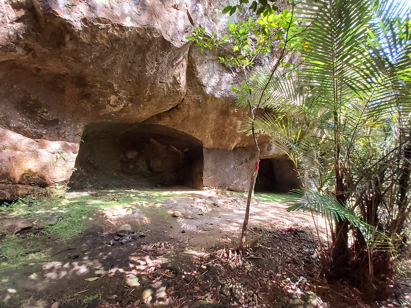
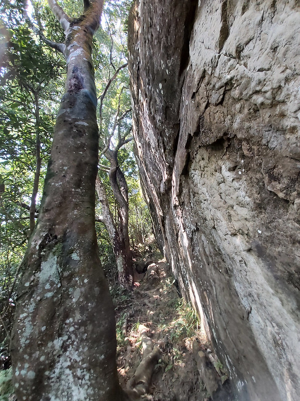
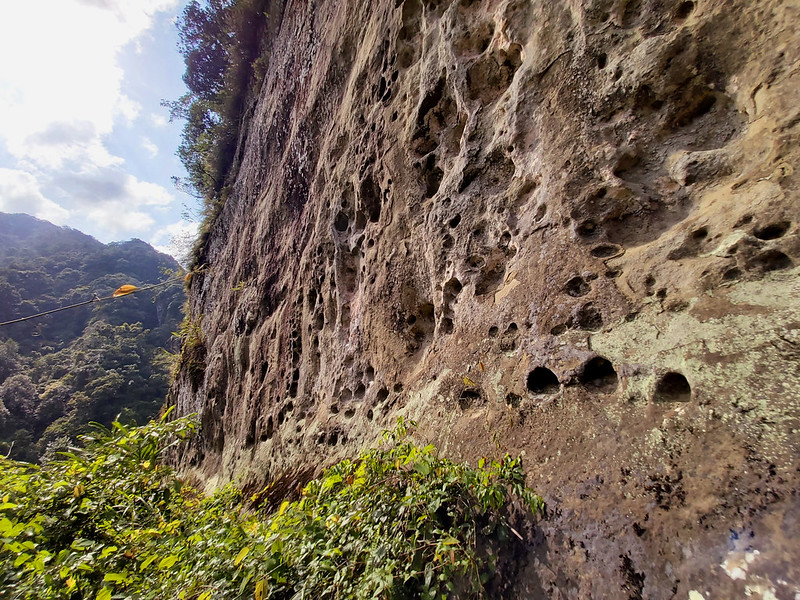
What was waiting for me was a flat ground and two big caves carved into the cliff wall. I think those caves looked more like bing carved by humans rather than by the nature. Some call them Glasses Caves, because they look like glasses or specs.
I followed the trail and reached another steep slope which was intertwined with tree roots. Then, the slope led me to a bare narrow ridge.
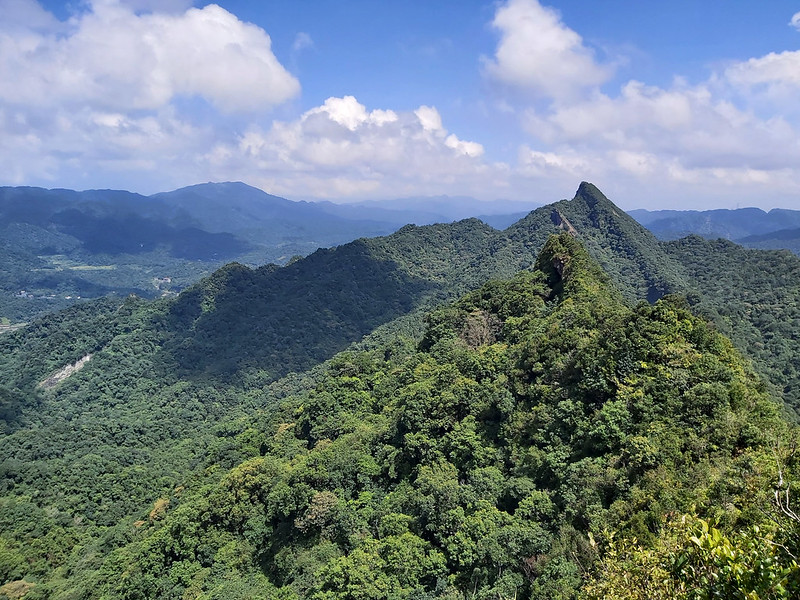
From there, I could see the landscape in Pingxi.

While enjoying the beautiful views from the ridge, I reached Shizhu Piton.

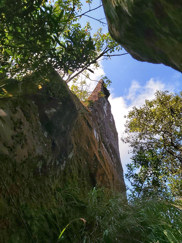
At first, I didn't know why this was called Shizhu, stone candle. Later I realized it wasn't the rock I was on, but the sharp distinct one I saw in front of me.
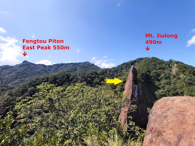
What I also didn't know that I was looking at the peaks and the ridgeline I was going to take later: Mt. Jiulong, Wumingjian and Fengtoujian East Peak.
Mt. Jiulong and Exciting Wumingjian
I had to get off the rock to continue my hike. If you think the previous ridge trail is difficult, traversing underneath Shizhu Piton is more challenging. I had to cross the big gaps among those big tree trunks hoping they could hold up my weight.

When I looked up, Shizhu Piton was like a dagger protruding into the blue sky.
When I got to a slightly safer ground, a short but slippery looking rock was waiting for me.
Then, I heard people coming. They were a small group of hikers and one of the guys asked me where I wanted to go with a hint of disapproval of my solo hike. I didn't remember what I said but I thought I would see them again later on the trail. I was wrong about seeing them again and I know why later.
After that encounter, I passed a huge rock wall, and I was on the narrow ridge again.
To my surprise, I reached Mt. Jiulong. There wasn't much to see on Mt. Jiulong, so I continued.
Within 30 minutes, I reached an opening of the trees and there was a sign saying Wumingjian 無名尖, literally meaning No Name Peak. I didn't see this on my map, but this was a great delight.
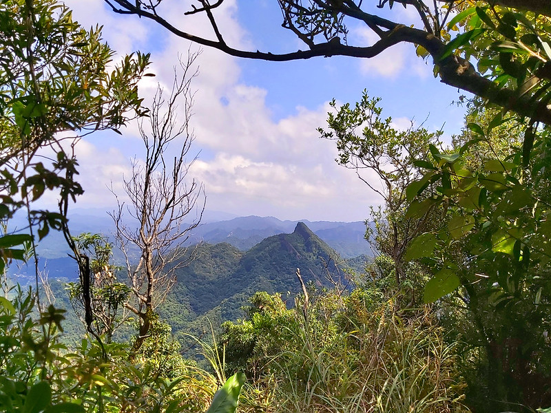
From Wumingjian, I saw Zhongyang Piton on my right and even more magnificent views of Pingxi.
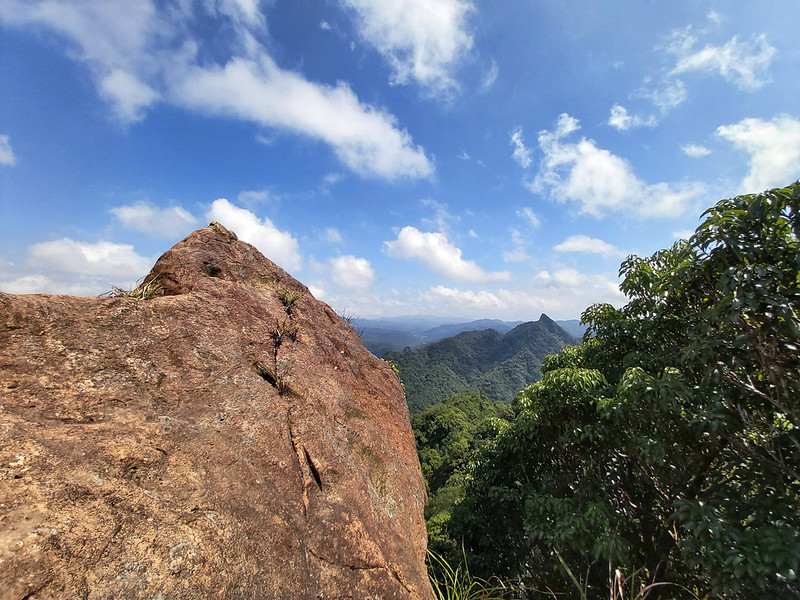
I thought about climbing up the rock to get a better view, but rock climbing wasn't my strong suit. Surprisingly, I still could get a mobile phone connection here, so I was jokingly asking Twitter whether I should climb up there. Some said yes, but I was happily being a coward. If I slip here, nobody will know I was there. Not a good idea.

I stayed there much longer to enjoy the wonderful weather and views. When I was on Wumingjian, I still could hear those hikers' voices.
More Challenging Hike Awaited Which Made Me Regret
But their volume died down when I went further. The following ridge hike still wasn't easy. It was up and down, and it was obvious that not many hikers had been here for a while.

Luckily, the mountain views on the side gave me encouragement to continue. I didn't want to take the same way back anyway. In hindsight, perhaps I should.
While I was hiking through in the woods, I saw something on the trail. It was a Formosa Muntjac. I've been hearing Formosa Muntjacs' barking a lot on the trails, but that was my first time to see it in person. It was about the size of a medium sized dog, but their barking could be heard miles away. I shot this video when I was on Tamsui-Kavalan Trail 淡蘭古道 to Waiao 外澳, and you can hear how loud it was.
I recorded Muntjac's cry today... pic.twitter.com/LuSX5KBFPt
— Anusha Taiwan Hikes (@AnushaHiking) May 30, 2020
While I was trying to take photos of it, it finally saw me and sprinted away. Luckily, a hiker shared his video shot near Mt. Yu with me. You can see how Formosa Muntjac looks like.
After 3 months of semi lockdown in Taiwan, wild animals are thriving without humans. A hiker took this video of a muntjac near the trailhead of Mt. Yu. I'm afraid they will have to hide again once we are back on the trails. #nature pic.twitter.com/EuoaOalomj
— Anusha Taiwan Hikes (@AnushaHiking) August 16, 2021
I continued my hike after the Muntjac's encounter. Zhongyang Piton was still faithful staying by my side while I was huffing and puffing.

Then I arrived at a junction and my map told me that I could take the longer one to Fongtoujian toward the west or the shorter one to Fongtoujian East Peak. I took the shorter one, hoping it would be easier. It was no brainer, right? Probably not on the trails in Taiwan. Shorter trails don't mean it takes less time to finish them.
The following hike was not short of narrow, barren rock ridges, and there was almost nothing for me to grab. I started cursing myself for not taking the same trail back. I also wondered whether the one to Fongtoujian would be easier because it's a more popular trail.

Reaching to Fongtoujian East Peak took me much longer than I thought, around 2 hours. Fongtoujian East Peak was also a big rock. As usual, I mostly stayed safe without climbing on the top of the rock and I took a lunch break here.
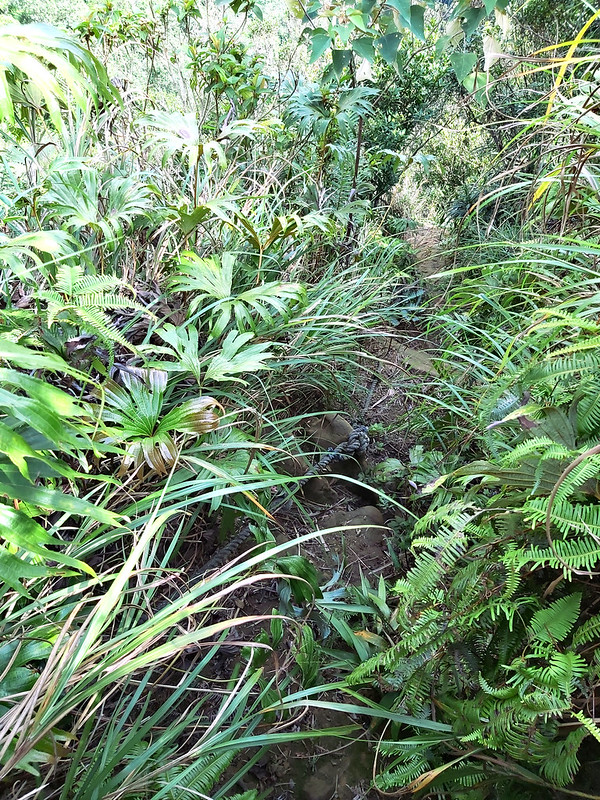
After I resumed my hike, the following trail was even worse. It was muddy, steep with overgrown grass almost covering the trail.
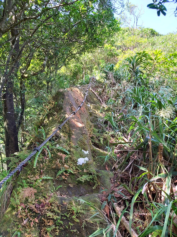
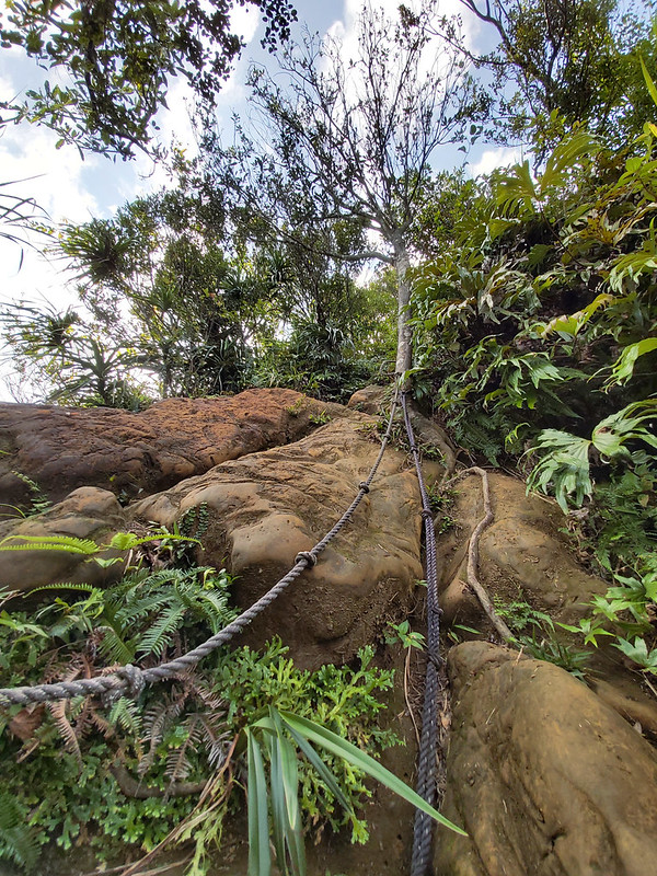
Then I saw a very steep rock slope, almost vertical. At this moment, I couldn't hold it anymore and let out a huge curse. There were ropes for me to grip, but I couldn't find strong enough tree roots or branches for me to hold on to. What made it worse was the ropes weren't long enough for me to reach the bottom with my feet. I had to grab a weak tree branch to steady myself. Then the branch broke. Luckily, I was almost reached the ground and landed safely.
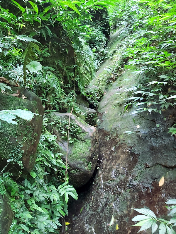
The following wasn't easy, either. When I saw ribbons and ropes left by hiking groups, I was so happy. Then, I realized why there were ropes over there, because hikers must go through a wet, big rock slope. That rock slope was so wet and slippery that I don't think shoe soles will get any friction on the surface.

I tried to bypass the slope by going through the other side, but it was worse. Then, I decided to sit down on the slope and slide on the slope with my butt, hoping my hiking pants will not give me any embarrassment later. I think I spent at least 10 minutes struggling to make myself pass this section safely.
Finally, I reached to a junction with a map and signs, and the terrain was mild enough to let me calm my nerves. I'm pretty sure my hiking friends who loathe solo hikers would make me promise that I will never do solo hikes again if they know what I had done, only if.

The Relaxing Dongshige Yueling Historic Trail with A Tranquil Creek
After reaching the junction, it felt like a totally different world. The trail was flat, mild and easy to hike. I was finally on Dongshige Yueling Historic Trail, the one I was supposed to hike.
If you walk along the creek, you'll find two lovely temples, one is Earth God temple and the other is Youying Temple 有應公. Taiwan Trails and Tales did a wonderful job about to explain the differences between those temples. You can take a look if you are interested.
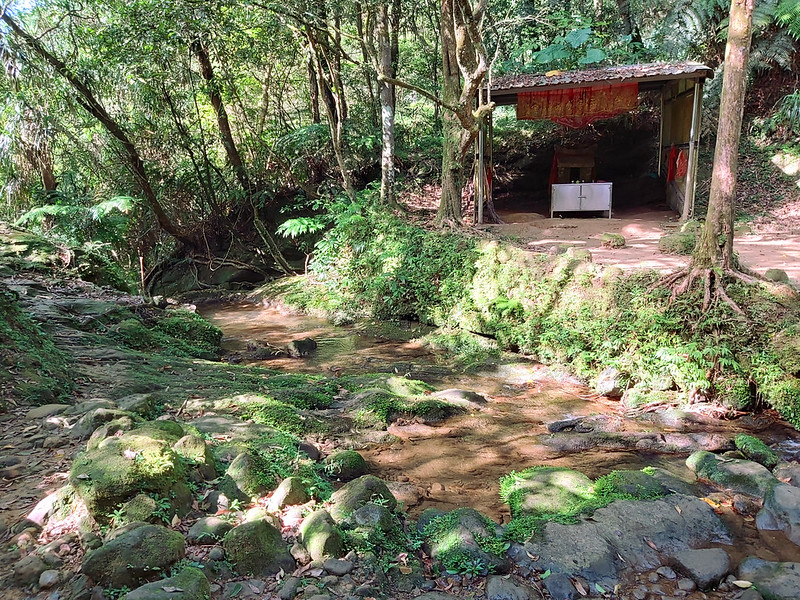
It was so relaxing to sit by the creek and enjoy the sunshine and water flowing, especially after my scary adventure.

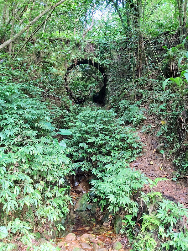
Continuing the walk, I found several old offices, mine caves and other machinery that were covered by plants.

My favorite one is this old cart track/disused tram (The map says this is a disused tram) over a small bridge.
I passed a junction to Cimu Peak (it said Tzmu Peak on the sign) and Mt. Xiaozi (Hsiaotz Mountain). I've been here from a different trailhead before, and it would be nice to visit again, although I was already exhausted.
I took the steps up, passed the beautiful cliff wall, and another stone steps. Then, I changed my mind. I was too tired to do this one at that moment. So, I turned back and called it a day.
Thoughts about This Trail and Other Routes to Enjoy Pingxi
As I mentioned earlier, there are many hiking trails to see the striking landscape in Pingxi and exciting slope climbing to enjoy. The route I did is still doable, but I think I would be more mentally prepared if I know I was going to take on so many the rough terrains and steep, slippery slopes.
Speaking of mentally prepared, the mistake I made here is I didn't stick to my plan. The gear I brought was enough for me to do this hike, because I always have the basic items in my backpack, like a headlamp, extra clothes, etc. However, being mentally prepared is also very important for your to have a safe hike.
There is another thing about hiking in Taiwan, when you check your map thinking, oh that terrain looks mild and flat, think again. I can't remember how many times I got my butt kicked on the trails because of this, even though I've been hiking for a while. Please don't underestimate the hiking trails in Taiwan. This applies to all kinds of trails in Taiwan, no matter it's in high mountains or near Taipei. The exceptions are those mostly maintained by local governments because most of those trails are paved by steps.
If you look for more exciting trails like this one, you can hike to Fengtoujian and do a bigger loop hike back to Pingxi Junior High School, instead of the east peak like I did.
I still want to do Dongshige Yueling Historic Trail someday and perhaps visit Mt. Xiaozi and Cimu Peak again in the future. If I get to do the trail, I'll definitely stick to my plan.
Have you been to Pingxi? Did you also get a chance to hike the trails nearby? Please leave comments below. Don't forget to subscribe to newsletters to know more about the exciting trails in Taiwan.
Map and Itinerary
Group Hike or Solo Hike: Solo hike
Date of Hike: October 2, 2021
Date of Hike: October 2, 2021
Route map for Pingxi-Shizhu-Crag-Fengtou-Crag-East-Wuming-Crag by Anusha Lee on plotaroute.com
Click Menu in the map to download, print or share the map.
Click to change the speed to meet your condition.
Note:
My GPS track may not be totally accurate and is for reference only.
Click
to change the speed to meet your condition.Note:
My GPS track may not be totally accurate and is for reference only.
Based on my hike on October 2, 2020
08:37
Arrived at the trailhead to Mt. Xiaozi and Zhongyang Piton near Pingxi Junior High School
08:39
Junction to Cimu Peak, Dongshigenon Rd. and Shizhu Piton
08:47
Passed the trail map and a footpath along the river
08:58
Passed Guakengliao Check Dam
09:16
Reached the stone steps
09:22
Passed two caves
09:30
Saw ribbons and went up to the steep rock ridgeline
09:47
Reached Shizhu Piton and saw the unique rock
10:05
Passed a rock wall
10:27
Arrived at Mt. Jiulong
11:01
Arrived at Wumingjian
11:33
Reached the junction to Fengtoujian and its east peak, and I took the one to the east peak
12:43
Arrived at Fengtoujian East Peak, and had lunch for 30 minutes
13:21
Reached a very steep slope and started descending
13:51
Went into a very slippery rock valley and it took me 10 minutes to pass it safely
14:01
Arrived at the junction with a map and a sign point to Fengtoujian, 90 minutes
14:12
Saw another map and started to hike on the easy footpath
14:27
Arrived at small creek with 2 earth god temples
14:34
Passed the old mine offices
14:42
Passed an old tram bridge
14:46
Back to junction to Cimu Peak and Mt. Hsiaoti
Total time:
6 hours 50 minutes, including breaks