Discover the Delights of Matcha Mountains: St. Marian Hiking Trail and Mt. Sanjiaolun in Jiaoxi Yilan
Embark on a captivating journey through the St. Marian Hiking Trail (Shengmu Hiking Trail) in Yilan, Taiwan, where natural beauty and adventure converge in perfect harmony. This picturesque trail is affectionately known as Matcha Mountain due to its vibrant greenery resembling the rich hues of matcha tea.
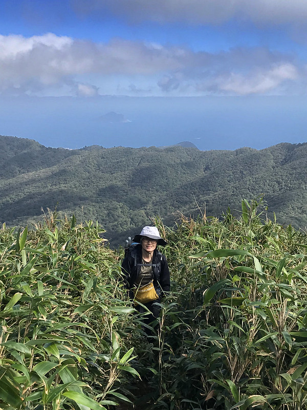
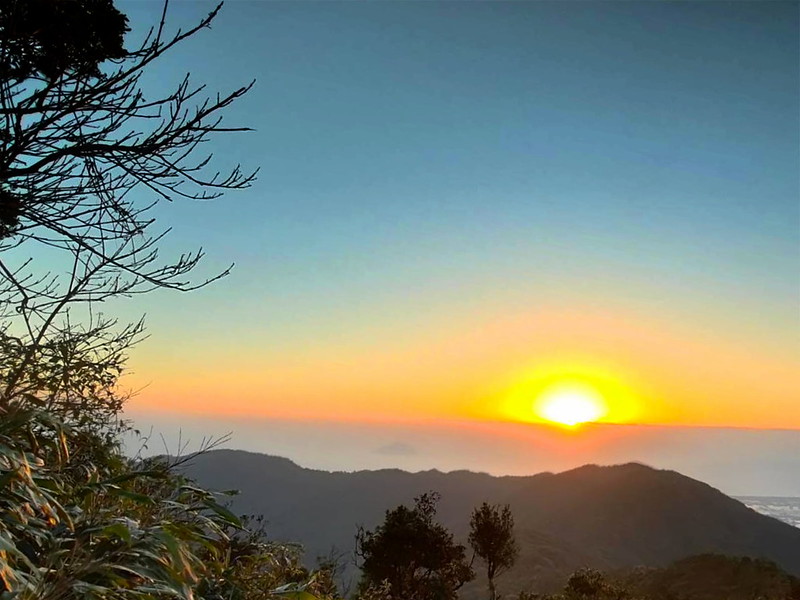
Another highlight is the magnificent Mt. Sanjiaolun. With its undulating slopes and picturesque landscapes, these captivating peak beckons adventurers to explore its hidden treasures. Turtle Island can be seen floating above the ocean.

When I wrote this post, my father passed away and is in a better place now. I want to dedicate this post to my dear father, J.T. Lee (August 8, 1925 - July 16, 2023).
Disclaimer:
All content is for inspiration only. Use Taiwan Hikes' suggestions at your own risk. We are not responsible for any losses, injuries, or damages.
Taiwan Hikes may include affiliate links. When you purchase through these links, you support our ability to continue providing FREE content — at no additional cost to you.
Table of Contents:
Exploring Taiwan? Save Time with the Ultimate 2025 Hiking Guide! Discover the top hikes in every city and county across Taiwan—all accessible by public transport (bus links available). We've spent 50+ hours researching the best trails and transit options, so you can skip the hassle and start your adventure!

Trail Information
Distance: 13.26 km (8.3 miles). According to the Forestry Bureau's website, the one-way trip from the trail entrance to the scenery platform is 1.63 km (1 mile). However, the complete breakdown of the hike is as follows:
⏺ From the parking lot at Wufengqi Scenic Area to 0 km sign: 700 meters
⏺ From the 0 km sign to the entrance of St. Marian Hiking Trail (Tongtian Bridge): 4 km
⏺ St. Marian Hiking Trail: 1.63 km
⏺ From St. Marian Refuge Hut to Mt. Sanjiaolun: 300 meters
Route type: Out and back
Days/Hours Needed: 6-9 hours
Total Ascent/Descent: 939m/939m
Best Time to Go: All year round
Permits: Not required
Difficulty Level:
Peaks to Reach
- Mt. Sanjiaolun 三角崙山, 1,029 meters (3,376 feet). This peak features a Class 3 Triangulation Stone and is listed as one of the Minor 100 Peaks in Taiwan. The round trip from St. Marian Shelter to this peak takes approximately 1 hour.
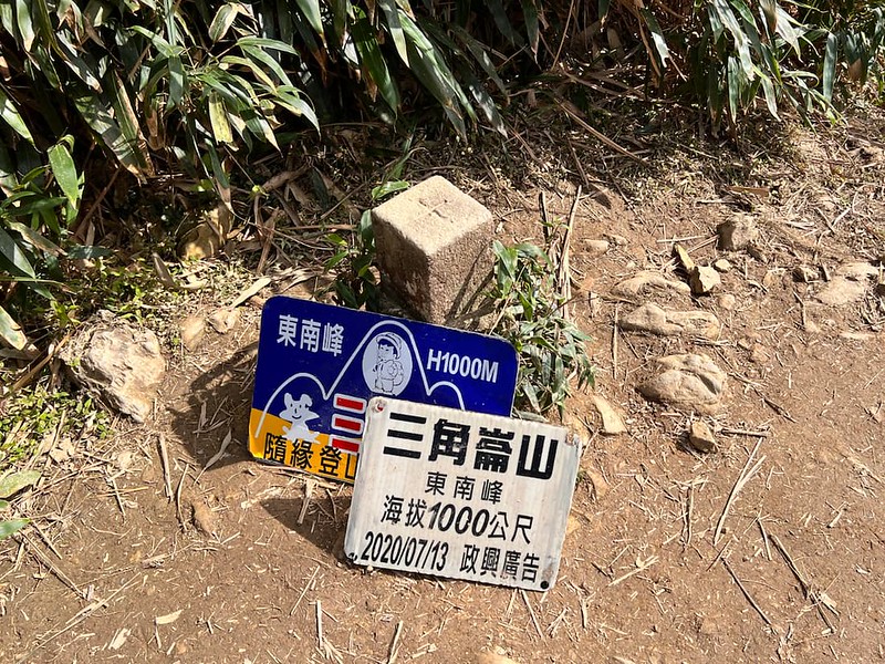
- Mt. Sanjiaolun Southeast Peak 三角崙山東南峰, 1,000 meters (3,281 feet).
Additional Information:
- The steep slope leading to Mt. Sanjiaolun requires hikers to utilize ropes for support. It can be slippery during rainy conditions.
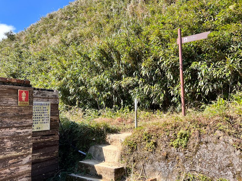
- At a junction along the trail, you can access BaTang Trail after the 0.3 km mark (0K + 300), which will lead you back to St. Marian Hiking Trail near Tongtian Bridge.
- Accommodation is available at St. Marian Refuge Hut, but applying for a stay in advance is necessary. While the name "Refuge Hut" may sound odd, it serves as a shelter for hikers, and I will adhere to its official title in this context.
Map/GPX Data
GPX of St. Marian Hiking Trail and BaTang Trail 聖母山莊 + 巴唐古道
You can skip Batang Trail and take the same trail back.
Route map for St Marian Trail And Mt. Sanjiaolun by Anusha Lee on plotaroute.com
Click Menu in the map to download, print, or share the map.
You can see more options after clicking the Play button.
Click to change the speed to meet your condition.
You can see more options after clicking the Play button.
Click
to change the speed to meet your condition.
Wufengqi Waterfalls Public Transport
St. Marian Hiking Trail
Your location ➔ Jiaoxi Transfer Station or Jiaoxi Train Station ➔ Wufengqi Scenic Area
Your location ➔ Jiaoxi Transfer Station or Jiaoxi Train Station ➔ Wufengqi Scenic Area
Taiwan Tourist Shuttle Jiaoxi Route A, aka Green 11 A 綠11A
Check the bus timetable.
Bus fare: NT$20 (NT$15 if you use EazyCard or iPass)
The first bus of Jiaoxi Route A on the weekdays at 8:50 and 8:35 on the weekends and holidays.
Bus fare: NT$20 (NT$15 if you use EazyCard or iPass)
The first bus of Jiaoxi Route A on the weekdays at 8:50 and 8:35 on the weekends and holidays.
When I checked public transport, I saw bus Green 11A or Green 11AA, which is confusing. If you are not sure when boarding the bus, ask the driver to make sure the bus is heading to Wufengqi 五峰旗風景特定區.
Note: the last bus back to Jiaoxi Station is 19:24 on the weekdays, and 19:36, but the actual time might vary due to the traffic. Please check the live arrival time when you go. Please don't go to the trail too late if you plan to take public transport.
Yilan Bus 112
Yilan Bus 112 is a loop route going from Jiaoxi Transfer Station to popular tourist attractions in Jiaoxi. The earliest bus leaving Jiaoxi Transfer Station is 10:30. Please check the live arrival time of 112.
Exploring Taiwan? Save Time with the Ultimate 2025 Hiking Guide! Discover the top hikes in every city and county across Taiwan—all accessible by public transport (bus links available). We've spent 50+ hours researching the best trails and transit options, so you can skip the hassle and start your adventure!
Matcha Mountain Route: St. Marian Hiking Trail and Stay at the Refuge Hut
Brief itinerary: Wufengqi Scenic Area parking lot ➔ 0km near the dam ➔ St. Marian Catholic Church ➔ Tongtian Bridge and the start of St. Marian Hiking Trail ➔ St. Marian Refuge Hut (shelter) and the scenery platform ➔ back to Tongtian Bridge ➔ Back to Wufengqi Scenic Area
A Hike Worth Doing Again
I've done this hike at least five times in the past six years. This post is based on the one I did on January 30, 2023.
My friend and I took an early bus from Taipei to Jiaoxi Transfer Station and waited for Yilan Bus 112. The bus is small and crowded passengers are expected.
09:08 We arrived at that parking lot at Wufengqi Scenic Area. You will find many toilets here. This place is also a popular tourist spot, and you can enjoy De Zi Kou Creek 得子口溪 nearby. We met Tom from New Zealand, and we struck up a conversation.
It turned out he was also an avid hiker who read Taiwan Hikes before coming to Taiwan. He was going to Lanyang (Yilan) Holy Ridge Thru Hike, the backward of the thru-hike from St. Marian Hiking Trail, Mt. Hongludi to Mt. Sanjiaolun (post coming soon).
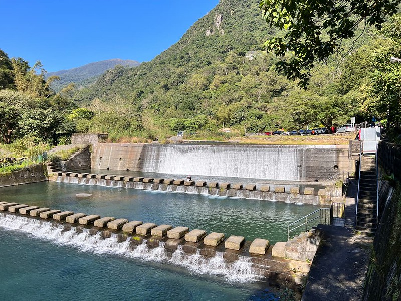
After bidding farewell to our new friend, we continued our hike. We walked along De Zi Kou Creek and passed a check dam.
Exploring Taiwan? Save Time with the Ultimate 2025 Hiking Guide! Discover the top hikes in every city and county across Taiwan—all accessible by public transport (bus links available). We've spent 50+ hours researching the best trails and transit options, so you can skip the hassle and start your adventure!
The First 4km Hike near Wufengqi Waterfall
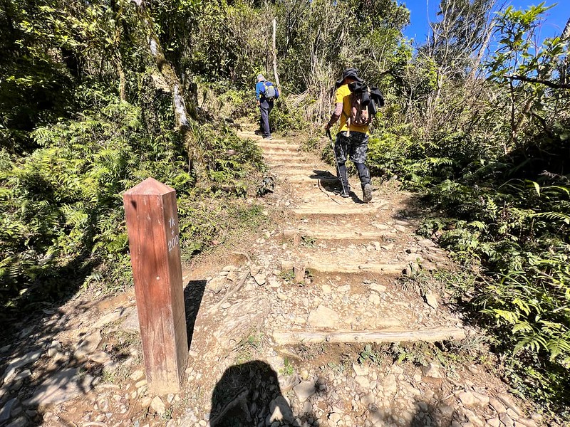
09:52 We passed the sign of 0 km. The following trail terrain is even and easy to hike. It's not natural terrain, but not the annoying hard concrete.

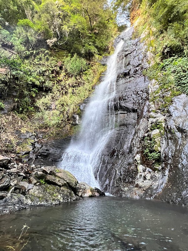
After taking the road for a few minutes, we passed the junction to Wufengqi Waterfalls. We decided to come back later if we had time.
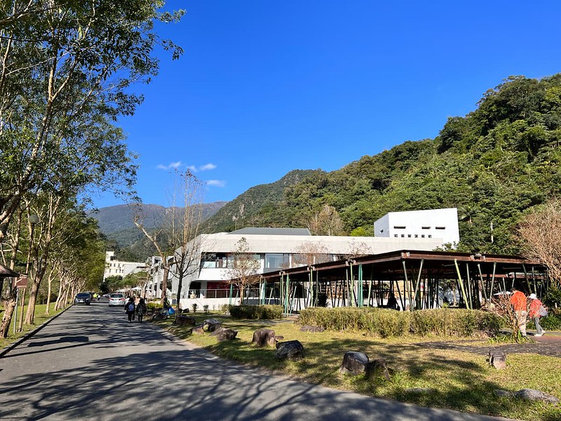
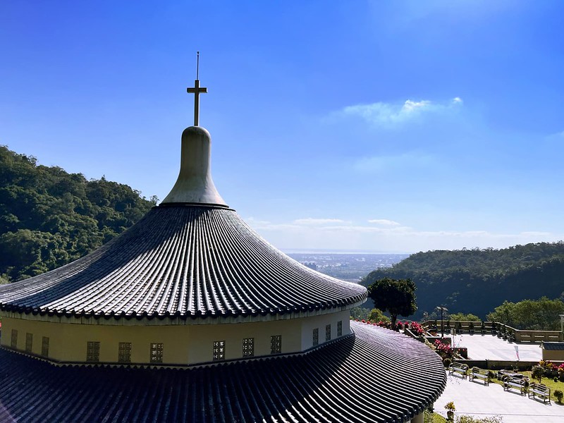
10:07 After taking the long zigzag road, we arrived at Wufengqi St. Marian Catholic Church 五峰旗聖母朝聖地. My friend and I have visited this church several times, so we didn't stop.
10:26 After passing the 2 km mark, you will find a small area to take a break. If you walk another 80 meters further, you will find toilets, too. The distance from this place to Tongtian Bridge is 1.8 km, and 3.4 km to St. Marian Refuge Hut.

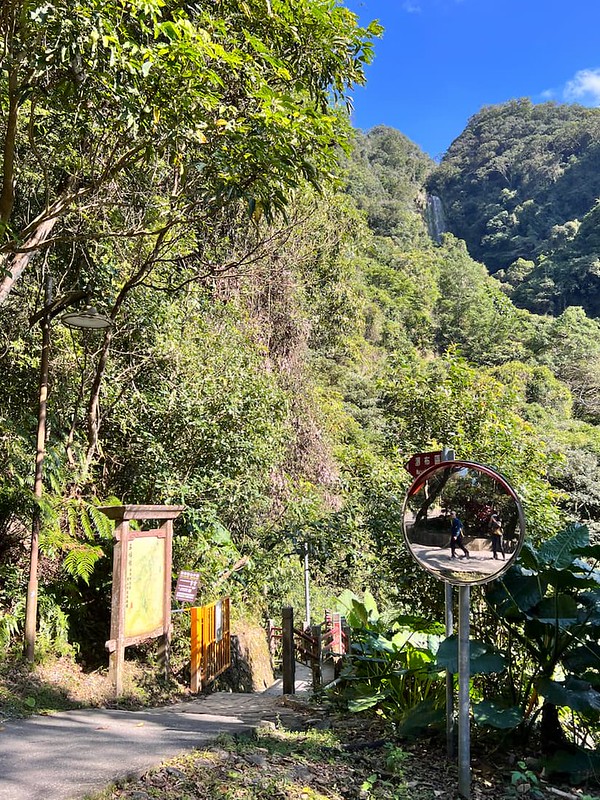
After passing the toilets, the shade became patchy, and we could see the scenery platform and Mt. Sanjiaolun.

Tongtian Bridge and St. Marian Hiking Trail with Beautiful Forest
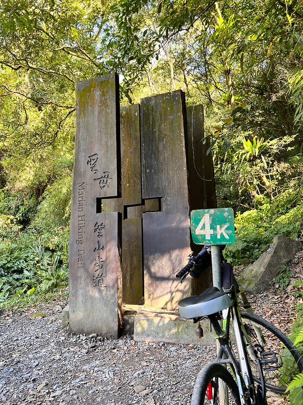
10:56 We reached the actual trailhead of Mt. Marian Hiking Trail, the end of 4 km, and Tongtian Bridge.
You will find toilets, faucets to clean up shoes/rain boots, and a pavilion to take a break.
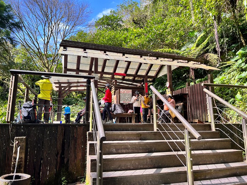
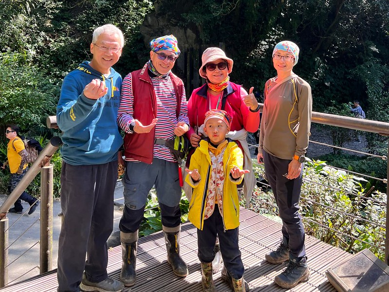
While we were here, we ran into our hiking friends and their grandson. They stayed at St. Marian Refuge Hut for one night and were on the way back when we ran into each other.
They are trying to bag the Minor 100 Peaks in Taiwan. His grandson is six years old and bagged 84 in June 2023. He's also the youngest hiking mate I've ever had. You rock, Kido!
After taking a break, we parted ways and started scaling up along a small creek. From here, expect steeper steps to the top.
Yet, the landscape from here is different from the previous 4 km. The gurgling sounds from the creek and lush forests gave us a great distraction while we were scaling up the steep steps.

Embraced the Scorching Sun at the Last 400 Meters
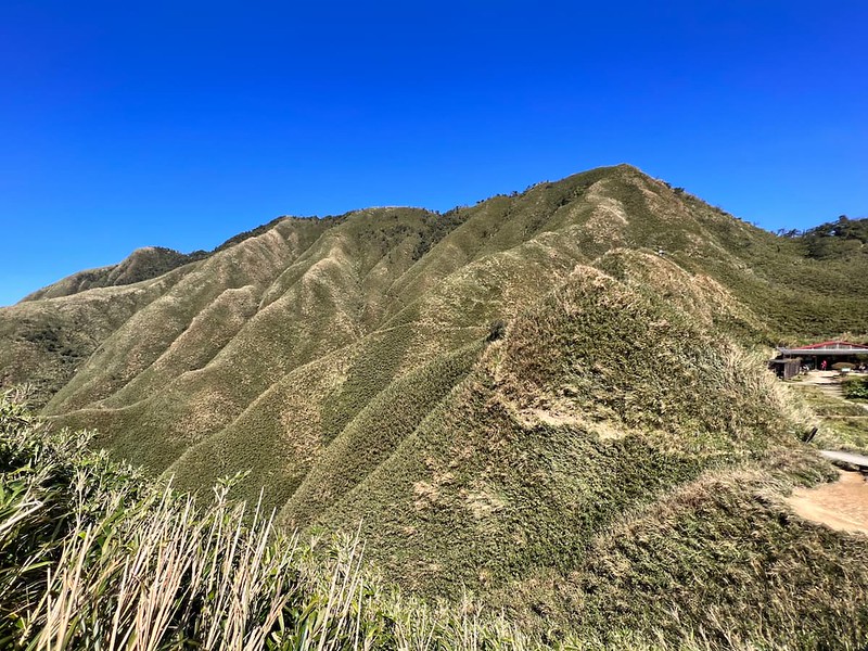
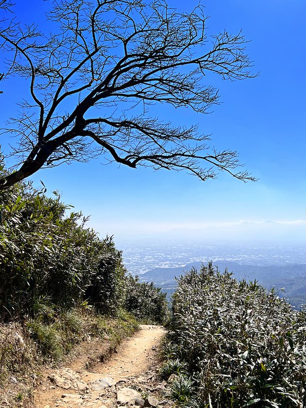
11:53 We passed the 1.2 km mark and entered the exposed section of the trail. The vibrant forests that shielded us from the sun were behind us. The vegetation changes into grassland, which looks like silky Matcha tea from a distance.
Although it was early spring, the spring sun could still be brutal.
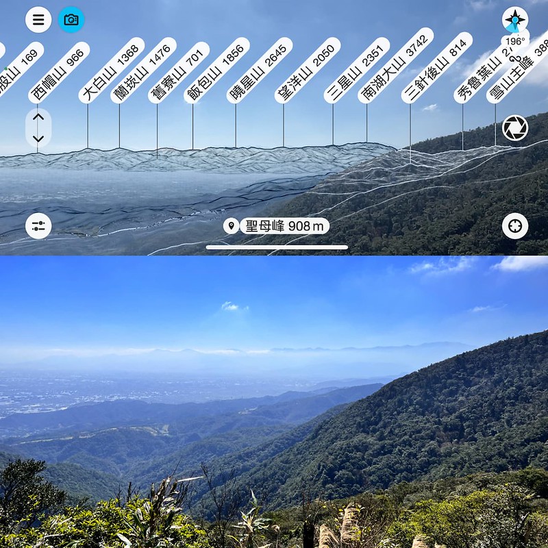
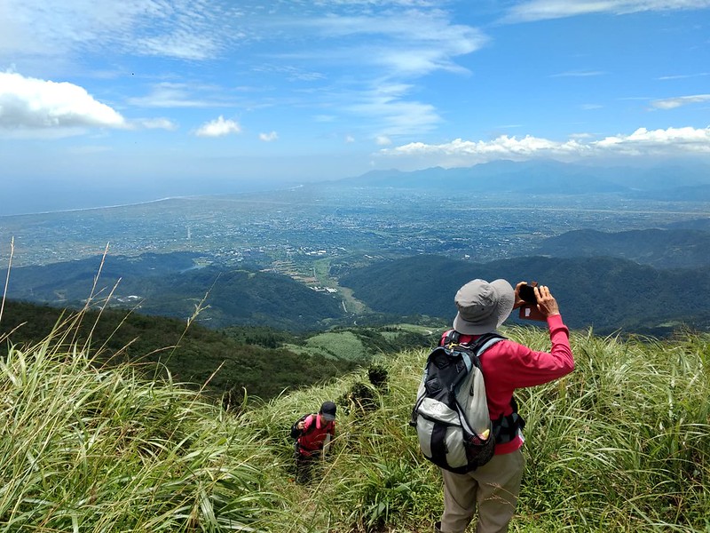
The reward of leaving the forests' protection was the open view of Lanyang Plain and layers of mountains in the distance. We even saw Mt. Nanhu 南湖大山, (3,742 meters) from the trail.
We passed the 1.5 km mark. A protruding tree waved its branches into the sky, giving us a nice view of framing the Lanyang Plain.
Exploring Taiwan? Save Time with the Ultimate 2025 Hiking Guide! Discover the top hikes in every city and county across Taiwan—all accessible by public transport (bus links available). We've spent 50+ hours researching the best trails and transit options, so you can skip the hassle and start your adventure!

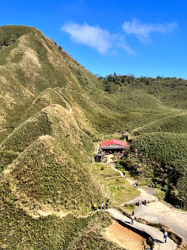
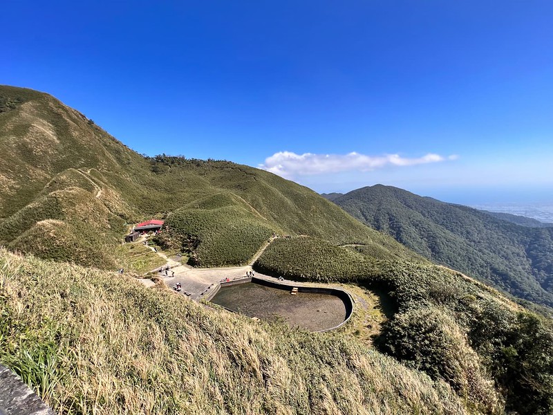
The Most Photogenic Spot: Matcha Mountain and St. Marian Refuge Hut
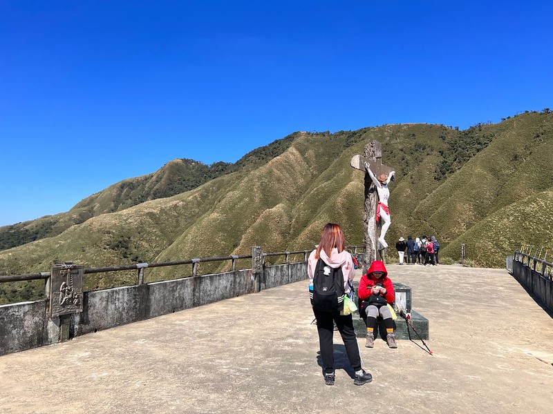
12:17 After reaching the top of the steps, the statue of Jesus Christ and a fire suppression pond finally appeared.
However, the hunger was stronger than the desire to see the views at that moment. My friend and I sat near the shelter and had our lunch. While having my lunch, I decided to shoot a timelapse video. The strong wind made the clouds look more dramatic in the video.
After lunch, I went to the platform to check out the surroundings. The views were stunning.
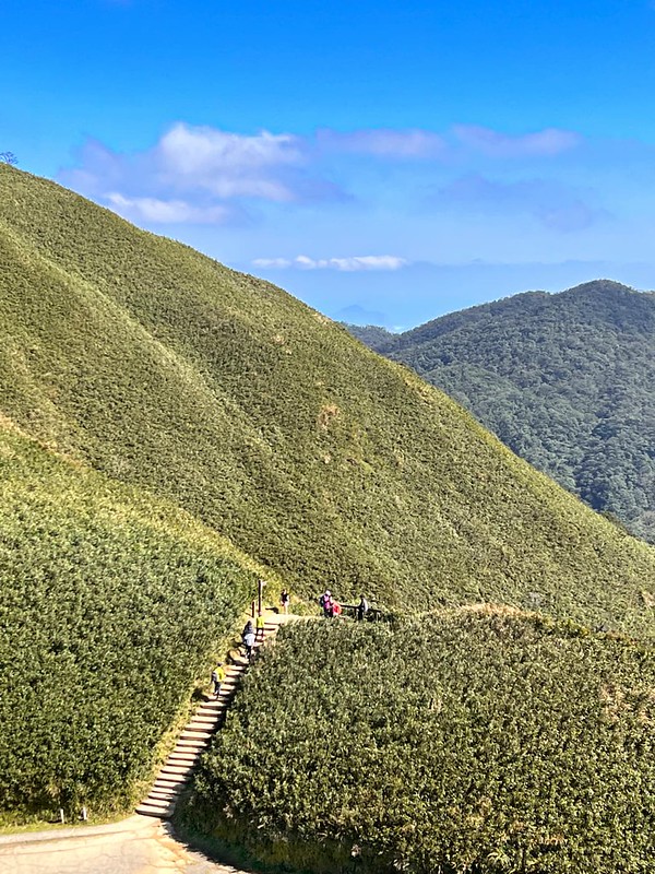
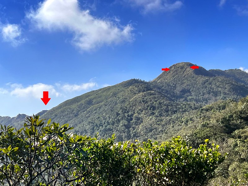
After a 50-minute break, we headed to Mt. Sanjiaolun. The entrance to this mountain is next to the shelter/toilets. You will see super steep steps with different rise heights.
Fun Climbing to Mt. Sanjiaolun
Remember to look back at the platform when you are on the way to Mt. Sanjiaolun.

13:18 We reached the junction to Mt. Sanjiaolun. You will see a sign going to Batang Trail.

What awaited us were two steep trails with slopes. Some hikers said one was for ascending and the other for descending to avoid traffic jams, but there weren't many people when we were there. We took the one on the right to go up.
13:30 We reached the top and Mt. Sanjiaolun Southeast Peak, 1,000 meters above sea level. The climbing was steep but fun. It can be muddy sometimes. The southeast peak is close to another trail with slopes. The view at Mt. Sanjiaolun Southeast Peak is decent, but we didn't stay long.
There was little elevation gain from here, but it was muddy despite the dry weather.
13:41 We reached Mt. Sanjiaolun, 1,029 meters above sea level. There is a Class 3 Triangulation Stone. The views were incredible. I hoped to shoot timelapse videos, but a guy occupied the peak and asked my super nice and friendly friend to help him take 100+ photos of him (it's not an exaggeration.)

Took BaTang Trail but Don't Recommend If You Are New to Trails in Taiwan
14:25 We returned to the junction and took BaTang Trail. I DON'T recommend taking this route if you are new to the trails in Taiwan. I even don't want to take this one again. It's more complex than St. Marian Hiking Trail, which is no big deal. Yet, there's little to see here. Moreover, I like the forest of St. Marian Hiking Trail better.

Looking back, I saw the slope with two routes to Mt. Sanjiaolun and the platform near St. Marian Shelter.
While returning to the junction, I saw a skeleton by the creek and was relieved to see it belonged to a big animal. I guess it was a deer.

15:43 We were back at the junction to St. Marian Hiking Trail.
15:50 We returned to Tongtian Bridge.
16:43 We were back at St. Marian Church and decided to visit the waterfall before it got dark.
Staying at St. Marian Refuge Hut
Since there's a shelter, can hikers stay here overnight? Absolutely, but hikers must apply for the stay in advance. A group of volunteer hikers maintain and clean up the trail and manage the hut.

You need to apply to become a member of the private Facebook group.
If you want to see the sunrise at the platform, the best time is one month before and after the winter solstice.
About St. Marian Trail, and Mt. Sanjiaolun, and Lanyang 5 Famous Mountains
St. Marian's Theophany, Brother Luigi Pavan, and BaTang Trail 巴唐古道
St. Marian Hiking Trail was built by an Italian monk, Brother Luigi Pavan, and volunteers in 1979. They carried all the materials to the top and built the platform for worshiping.
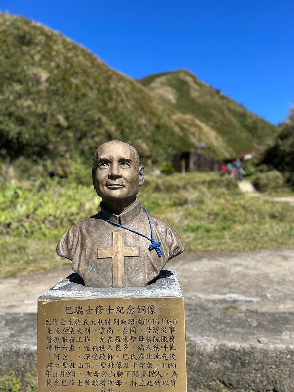
To build this hut, Brother Luigi Pavan and Mt. Tang Zhuanhe 唐傳和 blazed a trail to transport all the materials.
Later, a new trail was built to replace this trail. The new one is half the distance from the old one and was gradually taken over by nature. The new one became the famous St. Marian Hiking Trail nowadays.
Some enthusiastic hikers cleaned up the old trail and named it BaTang Trail to commemorate Brother Pavan and Mr. Tang. Ba here refers to Brother Pavan. You probably have noticed the messy translations in Taiwan.
On November 9, 1980, five hikers got lost in the fog. While trying to navigate, they saw a white shadow before them. Then, they found their way and made it home safely. They believed it was St. Marian's theophany pointing the direction for them (please forgive me if I didn't use the proper terminology here.) They built a statue of St. Marian to commemorate and thank St. Marian.
The steep steps with huge rises represent the Holy Stairs Jesus Christ took on his way to trial during his Passion. That's why it isn't easy to climb those stairs.
Brother Luigi Pavan devoted his life to patients, especially those suffering from TB, at Saint Mary's Hospital in Luodong, Yilan, for over two decades. He passed away on February 9, 1984, at the age of 68. Later, Brother Pavan's bust was built next to St. Marian's statue at St. Marian Refuge Hut, overlooking hikers and Yilan.
Lanyang 5 Famous Mountains 蘭陽五大名山
Five famous mountains are located between Wulai, New Taipei City, and Yilan. They are Mt. Yingziling 鶯子嶺山 (943 meters), Mt. Sanjiaolun 三角崙山 (1,029 meters), Mt. Hongludi 烘爐地山 (1,166 meters), Mt. Dajiaoxi 大礁溪山 (1,161 meters), and Mt. Ayu 阿玉山 (1,419 meters).
They belong to Xueshan Mountain Range 雪山山脈. Xueshan Mountain Range is the northmost mountain range in Taiwan and extends to Sandiaojiao. There's a beautiful lighthouse in Sandiaojiao, and Sandiaojiao is the eastmost point of Taiwan.
Free Guide: How to Apply for Hiking Permits in Taiwan
Do you plan to hike high mountains but don't know how to apply for hiking permits? Look no further! Download this complimentary guide with instructions to help you navigate the application process seamlessly.

I hope you enjoy this post. Have you done St. Marian Hiking Trail or the thru-hike? Are you planning to do it? Feel free to let me know in the comments below.
