Complete Guide of Mt. Teapot in Jiufen, Plus Mt. Canguanliao, Mt. Banping, and Mt. Nanzilin
Teapot Mountain is a must-do hike when visiting Jiufen in northern Taiwan. Known for its unique rock formations, stunning coastal views, and dramatic ridgelines, it has become a popular spot for Instagram photos. In this complete guide, you'll learn how to reach Teapot Mountain using public transportation, discover other hidden gems nearby, and understand why these trails should be included in your Jiufen itinerary.
Disclaimer:
All content is for inspiration only. Use Taiwan Hikes' suggestions at your own risk. We are not responsible for any losses, injuries, or damages.
Taiwan Hikes may include affiliate links. When you purchase through these links, you support our ability to continue providing FREE content — at no additional cost to you.
Table of Contents:
- About this Loop Hike
- How to Get There, Map, and Peaks to Reach
- Mt. Teapot: Easy to Get There but Scary to Get Out
- Mt. Banping: A Rock Ridgeline Hike with Panoramic Views
- Mt. Canguanliao with Class 1 Triangulation Stone
- Trails Nearby: Big and Little Ghost Waterfall and More
- Get Free Guides on Public Transport and Applying for Permits. Or Hire Me!
- Related Posts
About this Loop Hike: Mt. Teapot, Mt. Canguanliao, and Mt. Banping
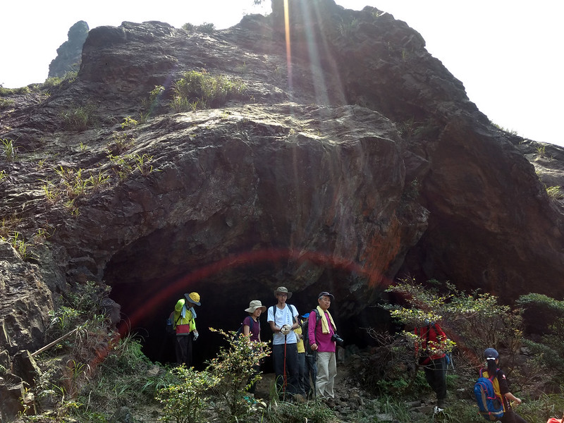
Important: Due to the landslides, the cave inside Teapot Mountain is closed. Hikers can only take the bypass around the mountain.


One thing I love about this hike is there are many exits, entrances, and different ways to enjoy. I've been here several times and still can find new things to explore.
For example, Baoshishan or Mt. Baoshi is a short yet fantastic trail. The trailhead is next to the Quanji Temple parking lot, and you can see the stunning mountains in Ruifang. Moreover, the round trip to Baoshishan takes less than 30 minutes.
Furthermore, you can decide to take all the trails or just some of them. After the hike, there are other attractions within walking distance to visit.
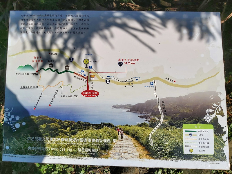
How to Get There, Map, and Peaks to Reach
From Taipei MRT to Quanji Temple 勸濟堂:
There are several ways to get to the trail entrance. My favorite and recommended one is to take Keelung Bus 1062 from Exit 2 of MRT Zhongxiao Fuxing Station, and get off at the last stop, Quanji Temple.
When you arrive at Quanji Temple, you can get some water and go to the toilet before hiking. Please also bring your trail food and lunch in advance.
From Taipei MRT to Gold Museum 黃金博物館:
Keelung Bus 1062 will also stop at Jingguashi or Gold Museum. There are toilets near Gold Museum, and you can also hike to Mt. Teapot from there.
From MRT Fuzhong Station 捷運府中站 to Gold Museum:
Take Bus 965 and get off at Gold Museum.
From Keelung Train Station to Gold Museum:
Take Bus 788 and get off at Gold Museum.
From Ruifang Train Station to Gold Museum:
Take Bus 856 and get off at Gold Museum.
Bus 856 also goes to Shueinandong (Shueinan Cave) 水湳洞 (where you can get close to Yingyang Sea 陰陽海), Bitou Cape 鼻頭角, Fulong Beach 福隆海水浴場 and Sandiaojiao Lighthouse (Magang) 三貂角燈塔 (馬崗).
From Ruifang Train Station to Mt. Nanzilin:
Take Bus 856 and get off at Nanya Nanxing Temple.
From Keelung Train Station to Mt. Nanzilin 南子吝山:
Take Bus 791 and get off at Nanya Nanxing Temple.
Map
Click the Menu in the map to download, print or share the map.
Click to change the speed to meet your condition.
Note:
Due to GPS accuracy setting, there may be some difference between my GPS tracking and the exact distance.
Click
to change the speed to meet your condition.Note:
Due to GPS accuracy setting, there may be some difference between my GPS tracking and the exact distance.
Uncover Taiwan's hidden gems - hotels, restaurants, transport, and more — on 
Peaks to Reach
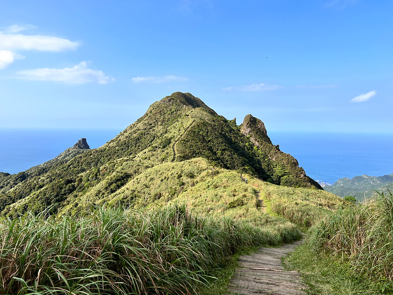
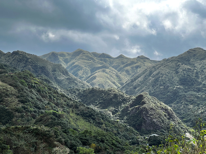
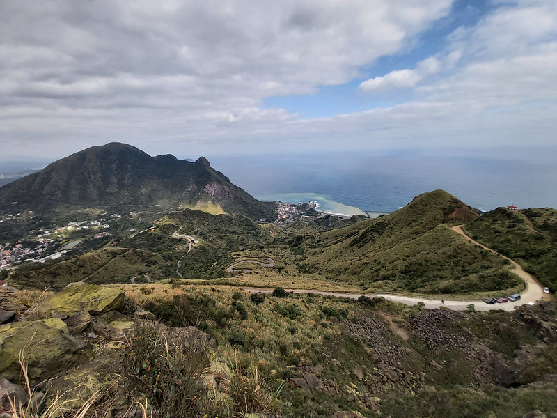
Mt. Teapot, aka Cha Hu Shan: 茶壺山, 590 meters (1,936 feet). The full name of Mt. Teapot is Wu Er Cha Hu Shan 無耳茶壺山, Earless Tea Kettle, meaning a kettle without the handle (ear here means "handle"). From certain places, this mountain does look like a kettle without a handle. Great views from the top, but getting inside and out of the cave can be dangerous.
Mt. Banping: 半平山/半屏山, 705 meters (2,313 feet). Mostly hike on the ridgeline with great views.
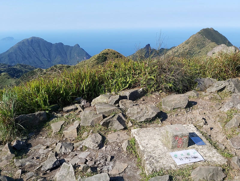
Mt. Canguanliao: 燦光寮山, 739 meters (2,424 feet). There is a Class 1 Triangulation Stone on the peak, and the views there are amazing.
Mt. Banping: 半平山/半屏山, 705 meters (2,313 feet). Mostly hike on the ridgeline with great views.
Mt. Canguanliao: 燦光寮山, 739 meters (2,424 feet). There is a Class 1 Triangulation Stone on the peak, and the views there are amazing.
Mt. Teapot: Easy to Get There but Scary to Get Out
GPS coordinates at Quanji Temple: 25.11063, 121.859658
GPS coordinates at Mt. Teapot trailhead: 25.108815, 121.866061
GPS coordinates of the trailhead near Gold Museum: 25.106738, 121.859866
GPS coordinates at Mt. Teapot trailhead: 25.108815, 121.866061
GPS coordinates of the trailhead near Gold Museum: 25.106738, 121.859866
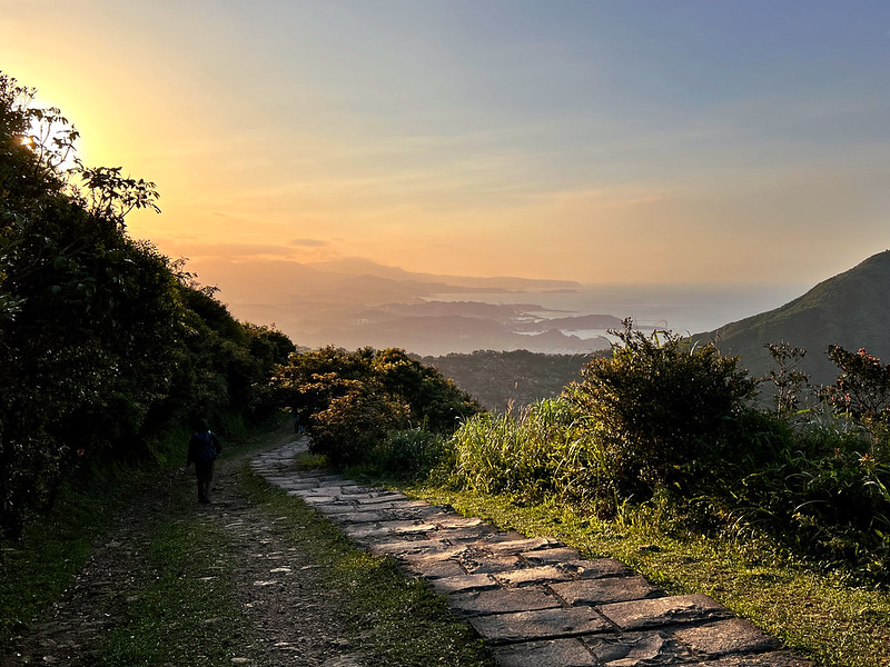
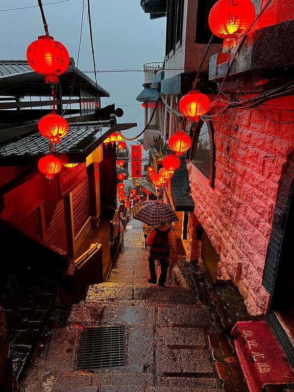
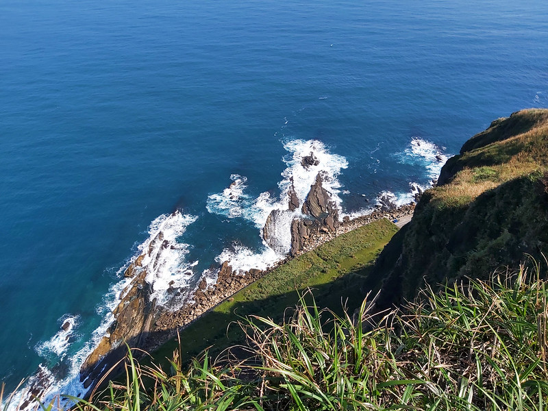
I took a stroll here before it got crowded with tourists in the early morning, and this reminded me of why many people, including myself, love Jinguashih and Jiufen so much. The old buildings, history, and mountains make this place so unique.

Two Trailheads to Reach Mt. Teapot
The first option is from Quanji Temple, taking the road to the parking lot. If you take this one, you can see the Yingyang Sea, and the views from the parking lot are great. Then you follow the signs and stairs, and you will find the trailhead to Mt. Teapot.

The second one is you can visit Gold Museum first and then take the trailhead near the museum to Mt. Teapot. You will see a sign pointing the direction to Mt. Teapot. This trail is obvious, just endless stairs.
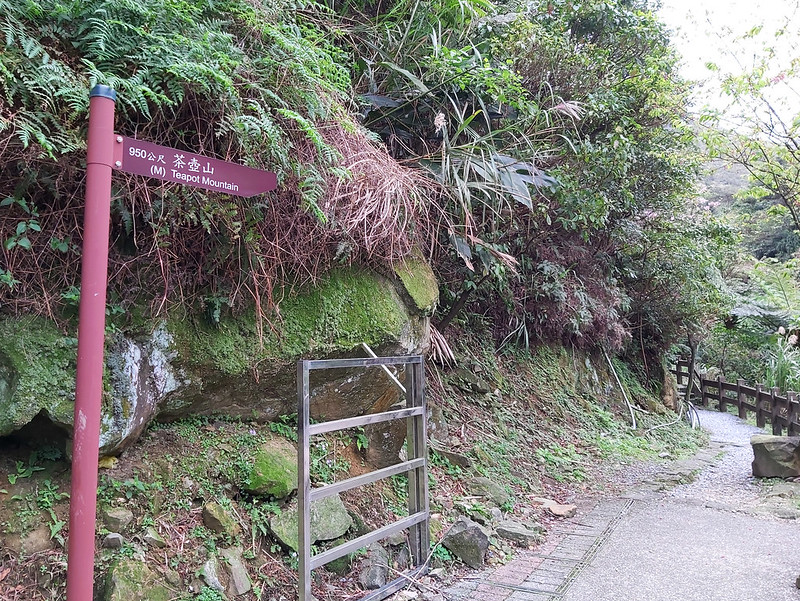
The second one is you can visit Gold Museum and then take the trailhead near the museum to Mt. Teapot. You will see a sign pointing in the direction of Mt. Teapot. This trail is steep, just endless stairs.
Option One: Get to Mt. Teapot and Return
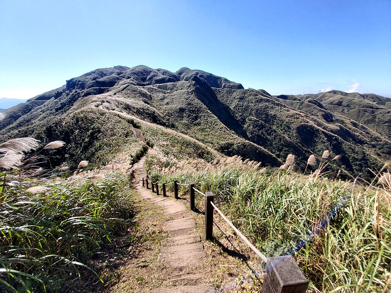
The front sections of the trail are mainly stone steps. After reaching a platform, the stone steps disappear, and the original trail terrains appear. I went to the lookout and saw a footpath extending from there. I took that one, but it was a dead end. The views at the end of the footpath were great.
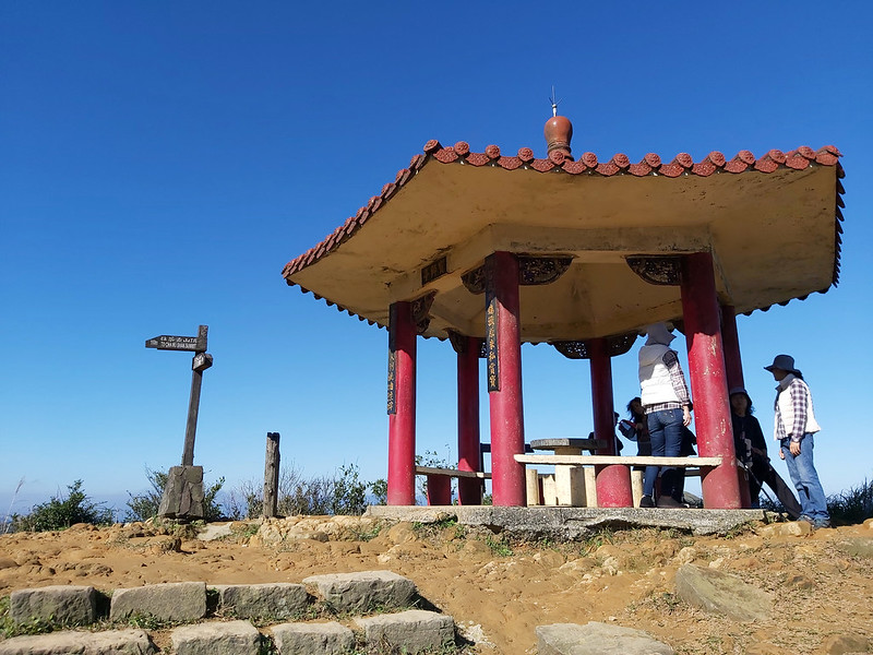
From the pavilion, Mt. Teapot looked like a pile of rocks. When you started climbing, it was indeed like rock climbing.

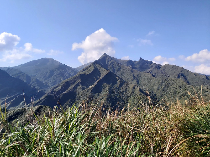
Mt. Banping: A Rock Ridgeline Hike with Panoramic Views of Northeastern Taiwan
GPS coordinates from the easy side of trailhead: 25.09627, 121.866867
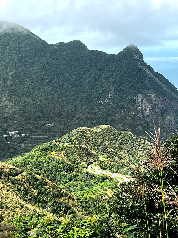
After finishing the bypass, you can continue to hike Mt. Banping.

A Detour to A Tableland and the Chimneys Ridges But Not Recommended
On the way to Mt. Banping, you will see an entrance cutting through Niufu Ore Body 牛伏礦體, to Gold Tableland 黃金台, Gold Cave 黃金洞, and Mt. Fuxing 復興山.
I took this trail twice, and it was so slippery and steep. From this photo, you can see where we descended, where Gold Tableland was. You can see a vast descent if you enter Gold Tableland.

This trail can also take you to hike the old chimneys left from the old mines. I urge people to refrain from taking this one because there have been accidents like hikers falling off the edge of the chimneys. Those chimneys are old and fragile, too.

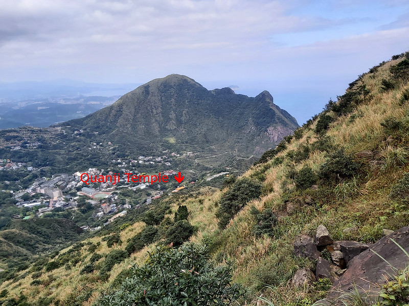
Looking at Mt. Nanzilin and Ruifang
When I looked back at where I came from, I could see Gold Tableland and Mt. Nanzilin Southeast Peak from the ridge.

Fun Rock Ridgeline and the Notorious Stegosaurus Ridge
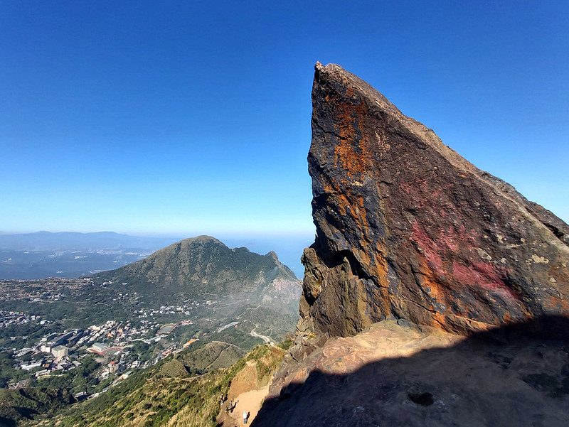
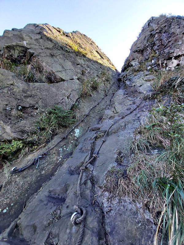
I reached the end of the ridge trail and had to climb the rock. There are carved holes for footing and rungs to grab, so climbing up is not difficult.
When I reached the top of the rock, the view of Mt. Keelung and Mt. Teapot looked terrific through the opening.

This was also a junction to two different trails, the one toward the south was to Mt. Banping, and the other was to the notorious Jianlong Ridge or Stegosaurus Ridge 劍龍稜 (video). Please note that usually, people don't get to Stegosaurus Ridge from the top. It's better to climb up to this ridge from the entrance of Mt. Nanzilin, and I'll explain this later.
Turn right to head to Mt. Banping.

The rocky ridge isn't long, and you will reach the summit of Mt. Banping soon.

Mt. Banping Might Be the Easiest If You Take Another Trailhead
The rest of the trail was easy to hike, and plank steps led to the junction and connected to the road. This might be the most accessible section of my loop hike if you take this one to Mt. Banping.
If you wish to continue your hike to Mt. Cangualiao, turn left after leaving the footpath.
Mt. Canguanliao: A Peak That Lets You See Mt. Nanhu (3,742 meters), Located 90 km Away
GPS coordinates from the easy side of the trailhead: 25.096079, 121.867199
The entrance to Mt. Canguanliao is very close to Mt. Banping, and you will see a sign there.

Some parts of this trail are rugged, and you have to climb some rock slopes, which are still manageable.
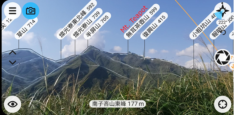
It took me around 25 minutes to reach the peak of Mt. Canguanliao. On the way to the peak, I used an app called PeakFinder, and I was delighted to find out that I could see as far as Mt. Xue Main Peak 雪山主峰 or Snow Mountain, 3,886 meters (12,749 feet) and Mt. Nanhu 南湖大山, 3,742 meters (12,277 feet), which were 90 km (55.9 miles) away from Mt. Canguanliao.

There was a Class 1 Triangulation Stone on the peak, and the panoramic views of mountains and sea were stunning. I almost forgot it was cloudy when I arrived in Ruifang that morning.
I Got the Peak to Myself
I can't remember how many times I've been to Mt. Canguanliao peak, but I remember I was fortunate to have gorgeous weather when I was on the top. So when you are on the top, you get to see the whole view of Ruifang: Shen'ao Bay 深澳灣, Mt. Keelung Main Peak and its East Peak, Mt. Banping, Mt. Cao 草山, Fulong Beach 福隆海水浴場, etc., the full 360-degree view.

Usually, this place was packed with hikers taking all kinds of photos. Lucky for me, I could go on the weekdays on both trips. It still took me a while to be left alone by other hikers. I sat there quietly, immersing myself in the surroundings.
Finally, when it was time to leave, I reluctantly pulled myself away from the spectacular views. You can take the same way back and connect to the road or take the other direction to the northwest as I did.

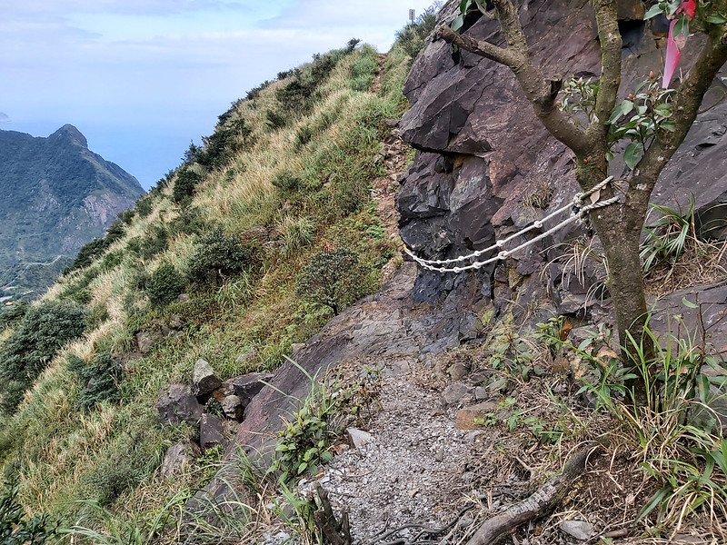
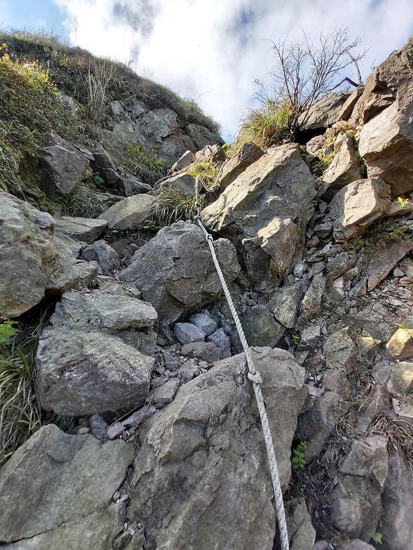
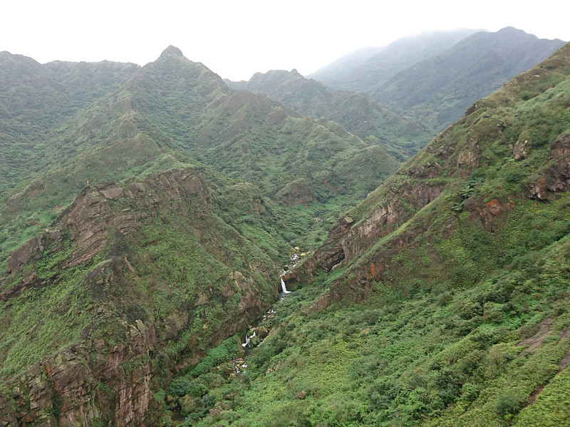
The following train terrain was rugged and steep, and it could be slippery sometimes. There were ropes on the trails to help you descend. Always proceed with caution.
When the views opened up, there were paddy-field-like layers on the hills. The mining industry left those in the old days.
Exploring Taiwan? Save Time with the Ultimate 2025 Hiking Guide! Discover the top hikes in every city and county across Taiwan—all accessible by public transport (bus links available). We've spent 50+ hours researching the best trails and transit options, so you can skip the hassle and start your adventure!

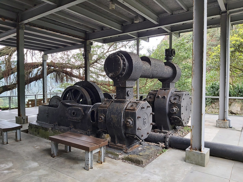
A Historical Site and Also Movie Scenes
One thing worth mentioning is some scenes of Martin Scorsese's historical drama, "Silence,", was shot here.
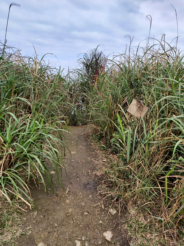
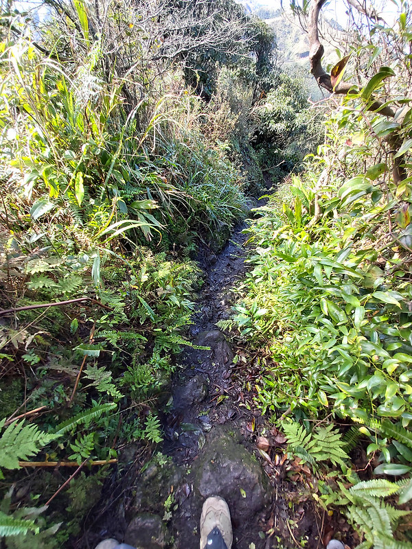
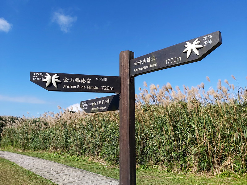
When I got out of the bushes and reached the grass slope, I could see Ganzidian Ruins 柑仔店, the ruins of the old grocery store, from the trail.


When you reach Ganzidian Ruins, you also have two options. The first one is getting back to Quanji Temple or Gold Museum. The second one is taking Canguanliao Old Trail. I have taken Canguanliao Old Trail before, and you can check out Taiwan Trails and Tales for the details about this beautiful trail full of history.
Trails Nearby: Big and Little Ghost Waterfall and More
Since there are so many trails around here, it's difficult for me to cover them all. Those mountains are just my personal favorites and where I keep coming back.
For more trips around here, please check out Northeast and Yilan Coast National Scenic Area Administration and Taiwan Trails and Tales to explore Tamsui-Kavalan Historic Trails.

Dagui Waterfall (Big Ghost Waterfall), Xiaogui Waterfall (Little Ghost Waterfall), and Xiaozhuilu Trail
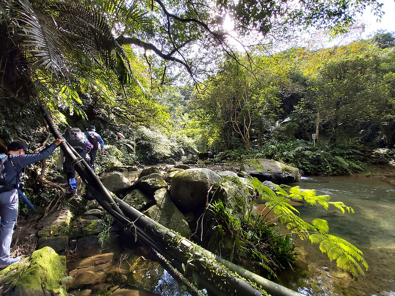
Other than those easy trails to hike, there's another trail that I don't dare to try, like the Stegosaurus Ridge hike. That is Dagui Waterfall (Big Ghost Waterfall) 大鬼瀑布, Xiaogui Waterfall (Little Ghost Waterfall) 小鬼瀑布 and Xiaozhuilu Trail 小錐麓古道 (yes, another with the same name but different from the one in Hualien).

This trail is also famous for river tracing and is popular in summer. My favorite hiking group, LOHAS, had this trip before, but I was too scared to try because it involved steep slopes.
Ruifang: Wonderful Place to Visit and Hike
There are so many wonderful trails in Ruifang, and it can take years to hike them all. Without a doubt, Ruifang is my favorite place to go hiking. You can check out Related Posts to see more attractions. But please also remember some trails are dangerous, and it's always Okay to turn back if you don't feel right.
If you get to visit here, please stay longer, and I'm sure you won't regret it.
Mt. Nanzilin: A Short and Sweet Hike to See Mountains Mentioned Above and the Scary Stegosaurus Ridge Nearby
After finishing Mt. Canguanliao, you can either take a bus or walk to the entrance of Mt. Keelung Main Peak if you still want to enjoy the trails.
However, if you want to spend less time on the trail but still want to see the epic mountain and ocean views, the trail to Mt. Nanzilin is for you. The round trip of this trail is 2 km (1.24 miles), and you will get to visit 2 peaks: Mt. Nanzilin and Mt. Nanzilin Southeast Peak. The views on both peaks are stunning.

You will find toilets near the temple before your hike. This is a popular trail; you can follow the crowd and take the stairs up. There will be some dirt trail, but very mild uphill.

I was surprised that Mt. Banping looked so different from this perspective. I could also see the trail going through Niufu Ore Body and heading to Gold Cave and Mt. Fuxing. It felt so surreal when I was able to see those trails where I've hiked.
If you aim for Stegosaurus Ridge, this is also one of the entrances to this challenging sharp ridgeline hike. There is a junction to Stegosaurus Ridge, and you will find a warning sign. This is because too many people were not fit enough or underestimated their fear of heights and ended up asking for rescue.

Before you go, please do thorough homework. The trail to Stegosaurus Ridge isn't for anyone. I don't plan to hike there, either.
Get Free Guides on Public Transport and Applying for Permits.
Free Bus Guides to Hike Popular Mountains in Taiwan
Taking buses to hike in Taiwan can be tricky if you don't read Chinese. Therefore, I've made several public transport guides to help you get to the trailheads. Or click the image below to see more details.