The Complete Guide to Hiking Taiwan's Southern Three Stars Part 3: Discover Mt. Kuhanuoxin
Welcome to the third installment of our Southern Three Stars series, focusing on the splendid Mt. Kuhanuoxin
along Taiwan's Southern Cross-island Highway. Based on actual hiking experiences, this comprehensive guide
provides essential tips and insights for a successful journey.
You will find the traffic control, permit applications, accommodations, and how to fully enjoy Mt.
Kuhanuoxin's natural beauty. Embrace the challenge and beauty of Mt. Kuhanuoxin and have a memorable
adventure.
Disclaimer:
All content is for inspiration only. Use Taiwan Hikes' suggestions at your own risk. We are not responsible for any losses, injuries, or damages.
Taiwan Hikes may include affiliate links. When you purchase through these links, you support our ability to continue providing FREE content — at no additional cost to you.
Table of Contents:
- Trail Information: Mt. Kuhanuoxin or Mt. Kuhanuosin (Kuhanuoxin Mountain)
- Accommodations, Transport to the Trailhead, and Map/GPX Data
- Permit Applications and Southern Cross-island Highway Traffic Control
- Itinerary of Mt. Kuhanuoxin Hike Starting from 4,000+ Steps
- About Mt. Kuhanuoxin, Gushan (Mt. Guan), and South Section One of the Central Mountain Range
- Free Guides: How to Apply for Hiking Permits in Taiwan. Or Hire Me!
- Related Posts
Exploring Taiwan? Save Time with the Ultimate 2026 Hiking Guide! Discover the top hikes in every city and
county across Taiwan—all accessible by public transport (bus links available). We've spent 35+ hours
researching the best trails and transit options, so you can skip the hassle and start your adventure!

Trail Information: Mt. Kuhanuoxin or Mt. Kuhanuosin (Kuhanuoxin Mountain)
Trail Name: Mt. Kuhanuoxin (Mt. Kuhanuosin, Kuhanuoxinshan) 庫哈諾辛山, listed as
No. 85 in the 100 Peaks in Taiwan. Nanheng Highway is short for the Southern Cross-island Highway.
Distance: 6.8 km (4.2 miles)
Route type: Out-and-back
Days/Hours Needed: 5-7 hours
Total Ascent/Descent: 984 m/984 m
Best Time to Go: All seasons, but winter is also the snow season. Yushan National Park will ask for hikers to declare the snow season form.
Permits: A police mountain entry permit and park permit are required.
Difficulty Level:
Peaks or Places to Reach
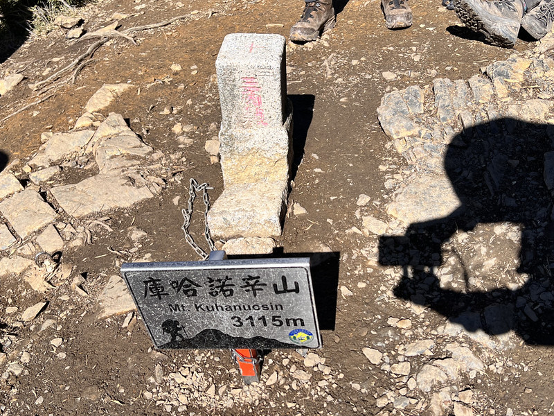
- Mt. Kuhanuoxin, or Kuhanuoxin Mountain 庫哈諾辛山, 3,115 meters (10,220 feet) above sea level. There's a Class 3 Triangulation Stone on the top. You can see Mt. Siangyang and other high mountains on the top.
Your support empowers Taiwan Hikes to create more FREE content, making your hiking adventures in Taiwan
even more enjoyable. Click "Buy Me A Coffee" or use our affiliate links to support.
Accommodations, Transport to the Trailhead, and Map/GPX Data
Hotels, Campsites, and Restaurants on the Kaohsiung/West Side
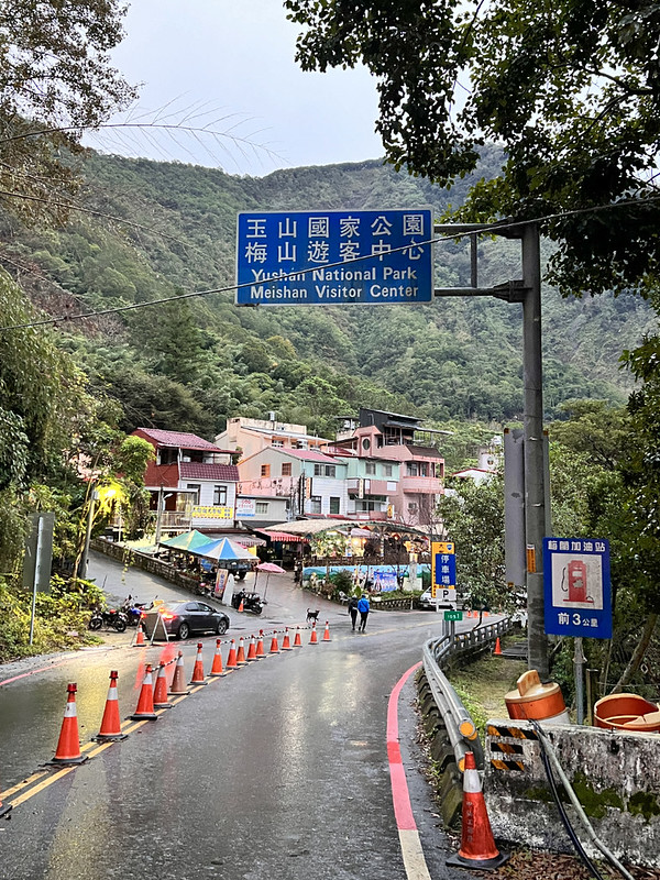
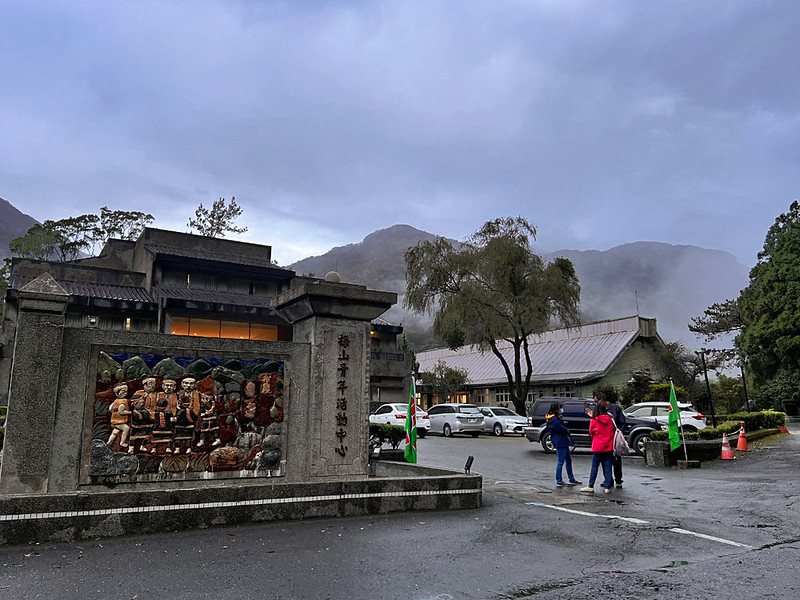
There are several hotels, B&Bs, and campsites near the Meishan Visitor Center 梅山遊客中心.
Meishan Youth Activity Center 梅山青年活動中心 is another option.
If you stay here overnight, you can save driving time to the trailhead, which takes around one hour.
Hotels, Campsites, and Restaurants on the Taitung/East Side: Siangyang Checkpoint
The closest hotels near Siangyang Checkpoint are in of Lidao Village Haiduan Township,
Taitung, or Motian Farm. It takes around 1 hour from Lidao Village to the Meishan
Checkpoint.

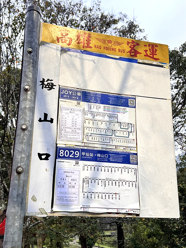
The West Side: Transport from Jiasian, Kaohsiung to Meishankou
Kaohsiung Bus 8029 goes from Jiasian Station 甲仙車站 to Meishan
Village at 9:00 and from Meishan Village Stop at 12:25. It takes around 1.5 hours from Jiasian Station to
Meishankou Stop (Or Meishan Mouth) 梅山口.
The bus stop is close to the Meishan Checkpoint of Southern Cross-island Highway
南橫公路西端梅山管制站.
Kaohsiung Joy Bus H11 Shuttle goes from Liugui 六龜 to Meishankou but the bus ride is long. Bus 8029 is faster.
The East Side: Transport from Siangyang Checkpoint of Southern Cross-island Highway 向陽管制站
There is no public transport to Siangyang Checkpoint.
Transport from Meishan Checkpoint of Southern Cross-island Highway to Mt. Taguan Trailhead
There is no public transport to the trailhead, either. Most people hire the pickup service from Kaohsiung. The
cost is around NT$5,000-6,000 per day.
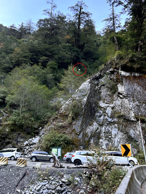
If you drive or ride a scooter, the parking area near the trailhead is at 33.5 km signage.
GPX Track
Route map for Mt. Kuhanuoxin by Anusha Lee on plotaroute.com
Click Menu in the map to download, print, or share the map.
You can see more options after clicking the Play button.
Click to change the speed to meet your condition.
You can see more options after clicking the Play button.
Click
to change the speed to meet your condition.
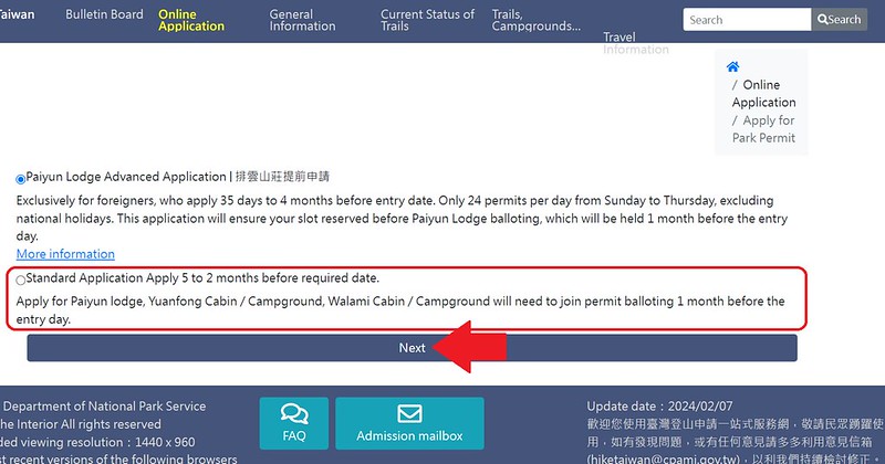
Permit Applications and Southern Cross-island Highway Traffic Control
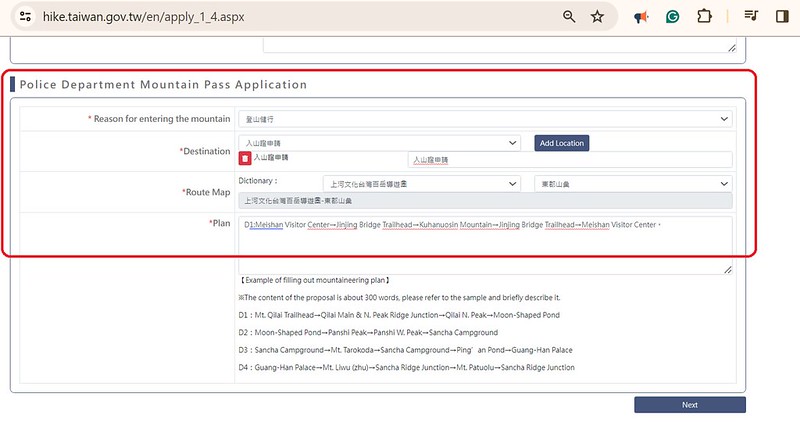
How to Apply for Police Mountain Entry Permits
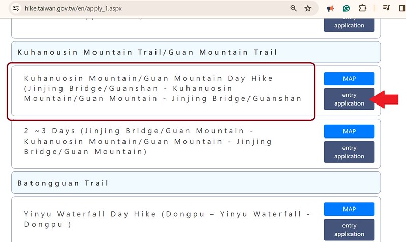
Go to Hike Smart Taiwan Service, the new website for permit applications.

Scroll down and find "Kuhanuosin Mountain Trail/Guan Mountain Trail." Click "entry application." Many
typos, I know.
Remember to read the content and check all the boxes. Then, click "I Agree."

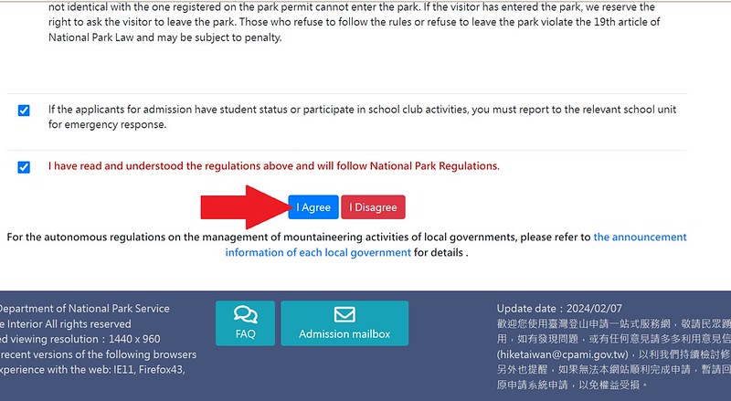

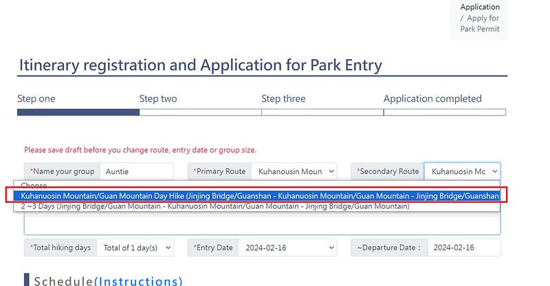
Enter your "Schedule": Meishan Visitor Center ➔ Jinjing Bridge Trailhead ➔ Kuhanuoxin Mountain
➔ Jinjing Bridge Trailhead ➔ Meishan Visitor Center

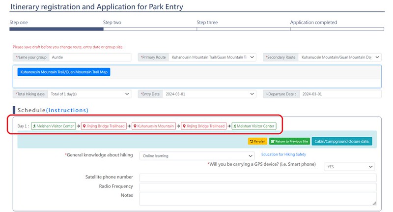
One of the few improvements of this new website is we don't have to go to the police agency's website to apply
for the Police Mountain Entry Permit. The new system will update the route you put in the "Plan" automatically.

Note: the daily cap to hike Mt. Kuhanuoxin is 100 people.
How to Self Check-in
If you have a Taiwanese ID card and want to hike before 9 am, please remember to self-cickle in at the Meishan
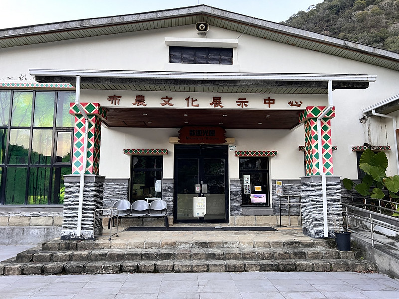
Visitor Center. When I did this hike, the Meishan Visitor Center was under renovation. We checked in at the
Bunan Culture Exhibition Center.
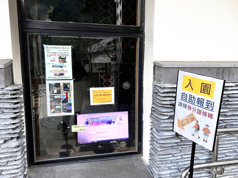
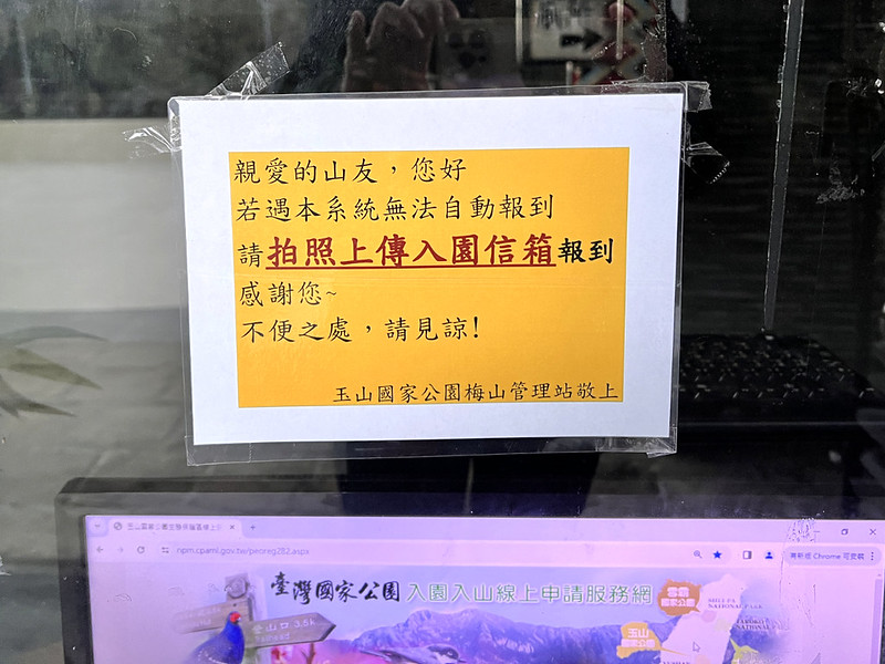
If you can't scan your ID or check in with a passport, please take a selfie with your passport and the scanner
with the time code and GPS coordinates in the image. Email the photos to the Yushan National Park's mailbox.
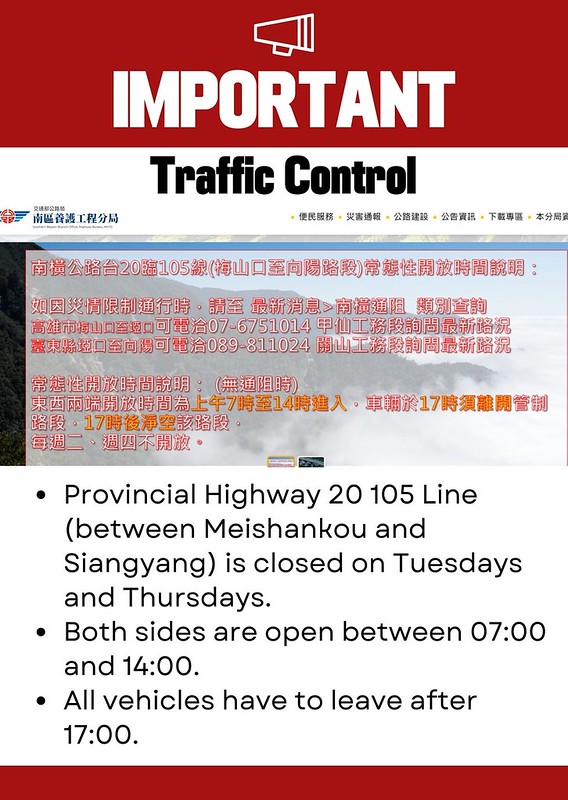
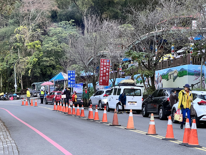
Traffic Control from Meishankou to Siangyang on Provincial Highway 20 of Southern Cross-island Highway
Check Yushan National Park's website for English information about traffic control. Click "Highway Traffic Control."
Or check Provincial Highway Real Time Information Service for the latest traffc control.
The section from Meishankou to Siangyang is closed on Tuesdays and Thursdays. Vehicles are allowed to enter from
both sides from 07:00 to 14:00. All vehicles must leave before 17:00. Vehicles with license plates are allowed
to enter. Bicycles are not allowed in this section.
When the highway becomes icy because of the cold weather, the Southern Region Branch Office of the Highway
Bureau will close the sections, too. Please check the Southern Region Branch Office's website
for details (only available in Chinese.)
Or call for the latest news: +886-7-6751014 on the Meishankou to Yakou side in Kaohsiung (高雄市梅山口至埡口), or +886-89-811024 on the Yakou to
Siangyang side (臺東縣埡口至向陽) in Taitung.
Itinerary of Mt. Kuhanuoxin Hike Starting from 4,000+ Steps
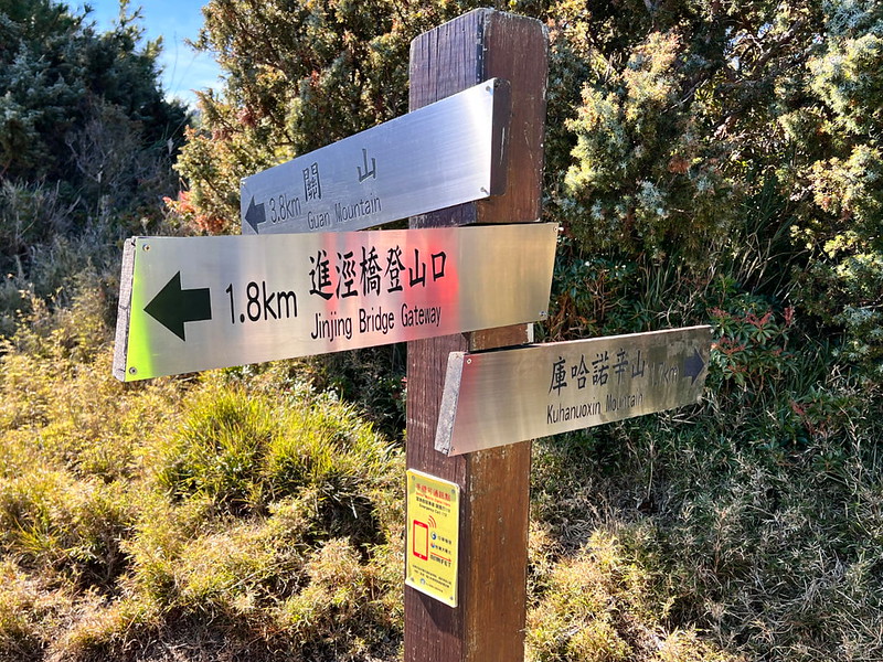
Brief itinerary: Jinjing Bridge Trailhead ➔ Kuhanuoxin Cabin ➔ Junction to Gushan and Mt.
Kuhanuoxin ➔ Mt. Kuhanuoxin ➔ Junction to Gushan and Mt. Kuhanuoxin ➔ Kuhanuoxin Cabin
➔ Jinjing Bridge Trailhead
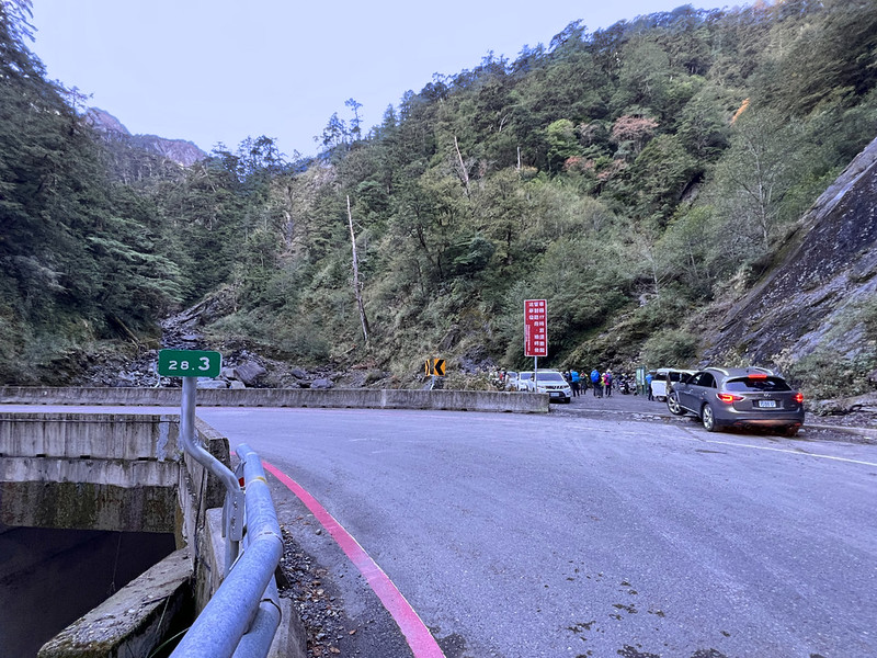
07:00 Passed the Meishankou Checkpoint.
07:52 We arrived at Jinjing Bridge 進徑橋 Trailhead. There were already several
cars here when we arrived. Expect crowds if you drive your car and do this hike on the weekends.
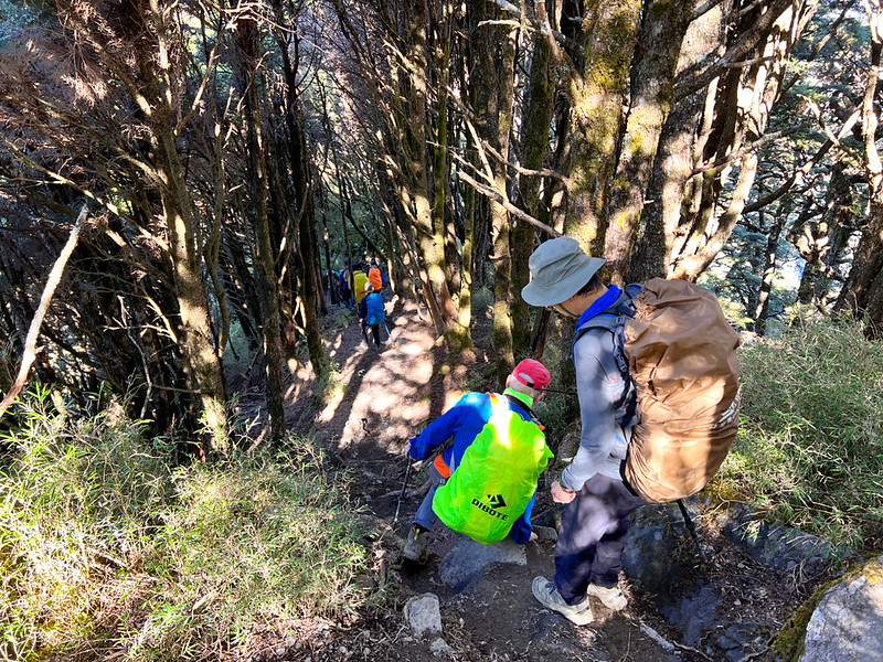
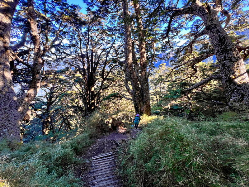
The trail demonstrated its authority by giving us a vast, steep climb. There are ropes on the side to assist
hikers going up, but please always test the ropes before you put on the whole-body weight to grab the rope.

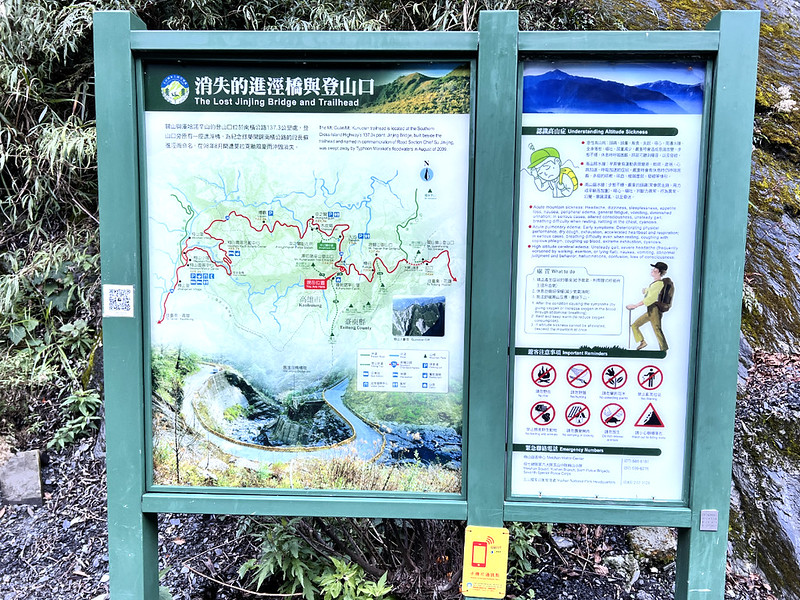
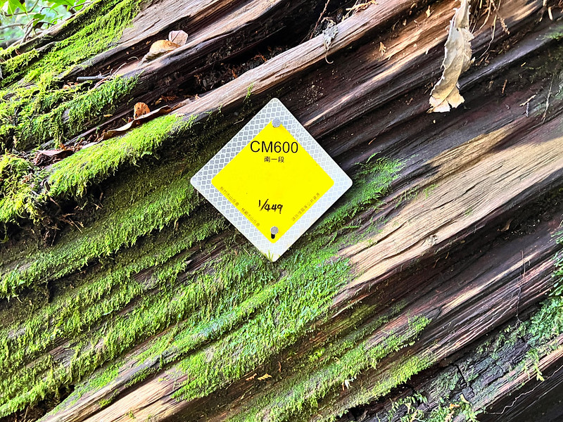
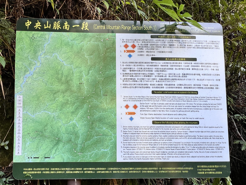
08:01 I saw the first signage of the South Section One. If you do this hike, you
will see 449 signages, 44.9 km (27.9 miles).
And a huge map of the South Section One of the Central Mountain Range.
Although there are 4,000+ plank steps before reaching Kuhanuoxin Cabin (or 3026 Highland 3026高地), it's still
daunting.

Many plank steps are rotten, collapsed, or with many high stair risers. They are either slippery or make my
thigh muscles scream.
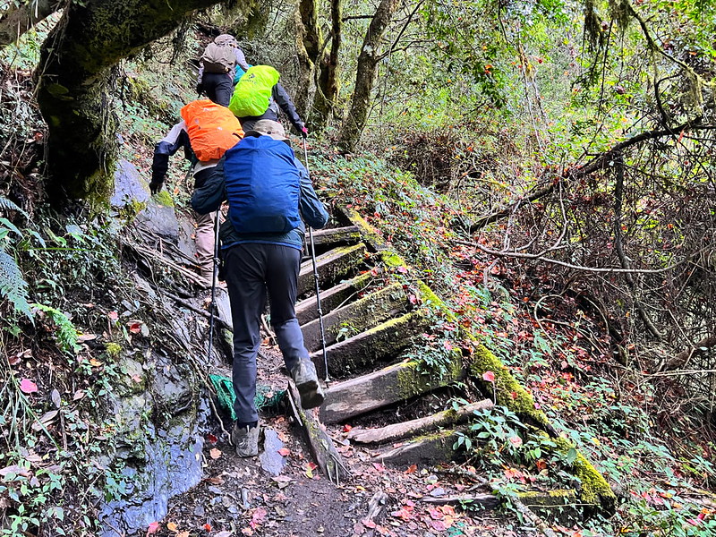
The magnificent giant trees were the comfort that supported me to keep going.

08:41 I passed a signage telling me there was 1.1 km to Kuhanuoxin Cabin.

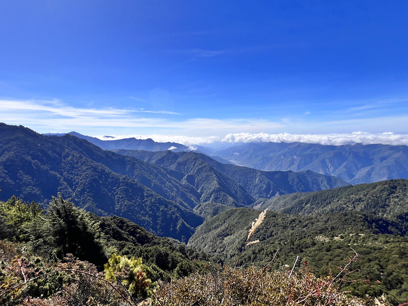
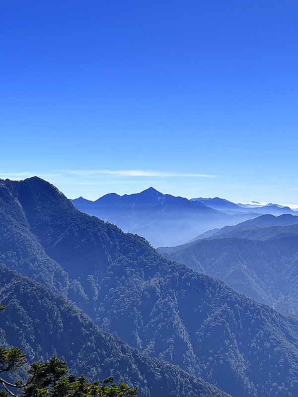
I saw some peaks through the trees. One was Yunfeng 雲峰, 3,564 meters (11,693 feet), one of the 100 Peaks in
Taiwan. Yushan was on the left, but the trees blocked the view.

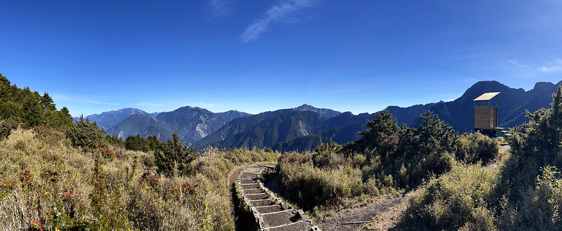
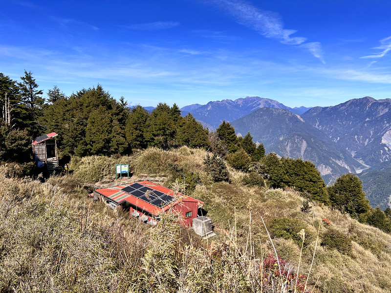
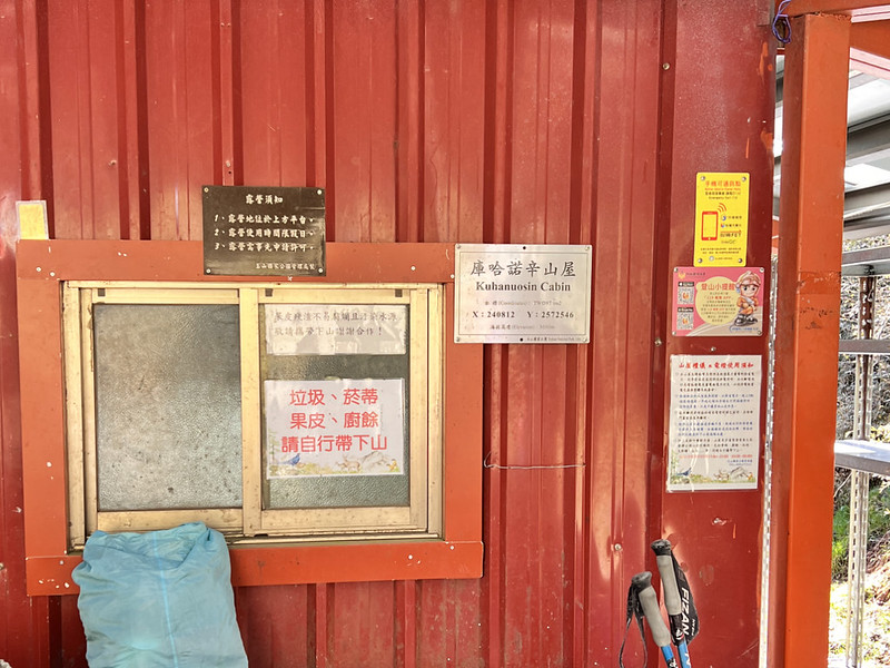
09:46 I reached Kuhanuoxin Cabin. There are water tanks and toilets in this
cabin.


10:16 After a 30-minute break, we reached the junction of Mt. Guan or Guanshan,
3,668 meters, and Mt. Kuhanuoxin.
You can't miss this lonely toilet near the junction if you make it this far. This may not be the highest toilet
in Taiwan, but it definitely has the best view among the high mountain toilets.
If you try it, keep the door ajar because it got stuck.

This will be a strenuous hike if you aim to hike Guanshan and Mt. Kuhanuoxin in a day. The round trip from this
junction to Guanshan is 7.6 Km (4.75 miles), and the round trip from here to Mt. Kuhanuoxin is 3.4 km (2.1
miles). Plus, the hike to the trailhead, the total distance is 14.6 km (9.13 miles).
We hiked a small section of flat trail and encountered a big descending to the saddle.
10:38 I passed a section with a significant scarp on the side.

And a signage of 1.2 km to Mt. Kuhanuoxin.
From here, more sections were covered by pine needles, one of my favorite experiences on the trails. Yet,
exhaustion quickly took over the pleasure.
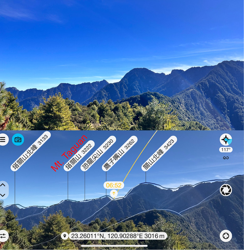
On the way to Mt. Kuhanuoxin, I saw Mt. Taguan, which I had hiked the previous day.
11:19 I reached the section with ropes and a signage of 0.2 km on the side. It
felt so close and so hard. You know I'm just a human.

11:26 Finally, I arrived at Mt. Kuhanuoxin, 3,115 meters above sea level.
Although we hiked on Monday, this place was still packed. Mainly because some hikers had to take 100+ photos
before being satisfied. Taking a peak photo is a competition in Taiwan.
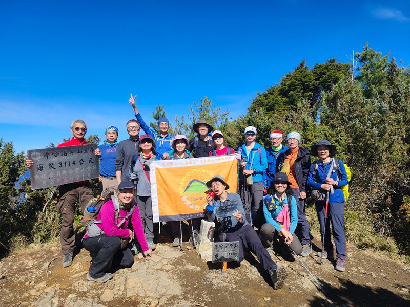
While waiting to take peak photos, I gulped down my lunch. It would be a more relaxing experience to enjoy the
views without being rushed. We took a 30-minute break here.

12:48 I got back to the junction to Guanshan and the toilet. I decided to use
the toilet.
Remember to stop for a second to admire the view of Kuhanuoxin Cabin with the fantastic landscape.
Soon, I reached the section of the 4,000+ steps. Many of them were slippery, and going down was more dangerous
than going up. Please proceed with caution.
13:53 I passed the map of the South Section One.
13:59 Returned to our vans.

About Mt. Kuhanuoxin, Gushan, and South Section One of the Central Mountain Range
About Mt. Kuhanuoxin and Southern Cross-island Highway Three Stars
Mt. Kuhanuoxin and neighboring Mt. Guanshanling and Mt. Taguan form the "Southern Three Stars" at the end of the
Central Mountain Range's middle section, located within Yushan National Park. The trailhead is on the Southern
Cross-Island Highway.
Hikers first tackle the tiring 4,000+ steps in the fir forests before reaching 3026 Highland. Enjoy panoramic
views of the Yushan peaks and the spectacular Guanshan Scarp 關山大崩壁 at the summit.

Mt. Kuhanuoxin Cabin/Campsite, at 3,026m, has a rainwater collection tower and bio-toilets. Hikers must apply
for permits to stay here and bring their sleeping bags, pads, and tents. The cabin can accommodate 24 people,
and the campsite accommodates 12 people.
Other Attractions on the Southern Cross-island Highway
Even if you don't do hikes, Southern Cross-island Highway is a breathtaking highway that worth visiting. After
we finished the hike, we saw the clouds floating around the valley and I wished we could just stop for a moment
to savor the amazing views.
Those are the stops that you should go if you come here:
- Xinliguan Observation Deck 新禮觀觀景台. You will find toilets here.
- Tianchi (Tian Pond) 天池 and Zhongzhiguan Historic Trail 中之關步道. Tianchi is an alpine lake in Taoyuan, Kaohsiung, with an elevation of 2,280 meters. Situated behind the Changqing Temple on the Southern Cross-island Highway, Tianchi has a heart-shaped appearance. The lake's water source relies on rainfall and melting snow, with an average depth of 1.2 meters and an area of about 1,800 square meters.
- Changchun Shrine 長春祠, built in 1979, was to honor the 116 engineers and workers who tragically lost their lives during the construction of the Southern Cross-island Highway.
For the stunning views here, please see Yushan National Park's video about the Southern Cross-island Highway. Or click the button below.
About South Section One of the Central Mountain Range 南一段
The South Section refers to the part of the Central Mountain Range from south of the Southern Cross-Island
Highway to the Beinan Main Mountain 卑南主山, including five peaks over 100 meters - Mt. Kuhanuoxin, Guanshan, Mt.
Hainuonan 海諾南山 (3,175 meters), Xiaoguanshan 小關山 (3,249 meters), and Beinan Main Mountain (3,295 meters), as well
as two famous 3000-meter mountains, Mt. Yunshui 雲水山 and Mt. Maxibashiu 馬西巴秀山. Source: Hiking Biji.

The most challenging aspects are water sources and the abundance of prickly Taiwan Juniper 刺柏. This route
ultimately leads from Shishan and Xinan Mountain to Tengzhi Forest Road. You can see my hike to Shishan and Shishan Xiu
Lake 石山, 石山秀湖.

Guanshan and Mt. Kuhanuoxin Hike
Some hikers will hike Guanshan and Mt. Kuhanuoxin in a day. This demanding hike will take at least 14.4 km (8.9
miles).
Guanshan, a prominent peak on the main ridge of the southern Central Mountain Range in Taiwan, stands as the
highest peak in the south range at 3,668 meters, with a Class 2 Triangulation Stone. It's located in Haiduan
Township of Taitung County and Taoyuan District of Kaohsiung City, on the southwest boundary of Yushan National
Park.

Surrounded by steep terrain, its northeast connects to the main ridge towards Mt. Xiangyang, featuring natural
wonders like the Guanshan and Xiangyang Scarp. The Mt. Konglongjian 恐龍尖山 section is particularly challenging.
Many hikers avoid this section and take the route through Mt. Kuhanuoxin to Jinjing Bridge trailhead.
Get Free Guides on Public Transport and Applying for Permits. Or Hire Me!
Free Bus Guides to Hike Popular Mountains in Taiwan
Taking buses to hike in Taiwan can be tricky if you don't read Chinese. Therefore, I've made several public transport guides to help you get to the trailheads.
