Discover the Hidden Gems Beyond Jancing Historic Trail and More
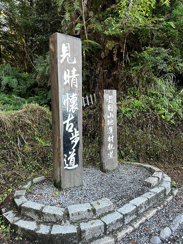
The Jancing Historic Trail, also known as the Jianqing Huaigu Trail, stands out as one of Taiwan's most picturesque, albeit shortest, rail trails. Nestled in Taipingshan, this trail has garnered global admiration.

While most visitors traverse the 900-meter path and turn back, we ventured further (with the necessary permits) to explore the ancient railway and a segment of the Jialuo Lake Trail before making our way to the Chinese Hemlock National Trail.

Disclaimer:
All content is for inspiration only. Use Taiwan Hikes' suggestions at your own risk. We are not responsible for any losses, injuries, or damages.
Taiwan Hikes may include affiliate links. When you purchase through these links, you support our ability to continue providing FREE content — at no additional cost to you.
Table of Contents:
- Jancing Historic Trail and Trail Information
- Beyond Jancing and Hike Part of Taipingshan-Jialuo Lake Trail
- Chinese Hemlock Trail and Taipingshan, Plus Trail Information
- How to Get There and Apply for Permits If You Hike Beyond
- Map/GPX Data
- About Taipingshan Logging History
- Free Guides: How to Apply for Hiking Permits in Taiwan. Or Hire Me!
- Related Posts
Exploring Taiwan? Save Time with the Ultimate 2025 Hiking Guide! Discover the top hikes in every city and county across Taiwan—all accessible by public transport (bus links available). We've spent 50+ hours researching the best trails and transit options, so you can skip the hassle and start your adventure!

Jancing Historic Trail and Trail Information
Trail Name: Jancing Historic Trail
Distance: 1.8 km (1.1 miles). The Jancing Forest Railway was approximately 5.5 km (3.4 miles) long. But now only 0.9 km is safe for people to enjoy. So tourists have to return at the 0.9 km mark.
Route type: Out and back
Days/Hours Needed: 1 hour, but I'm sure you will spend more than one hour enjoying this beautiful trail.
Total Ascent/Descent: Very flat
Best Time to Go: All year round. At an elevation of 1,930 meters, this is a great hike to escape the summer heat in Taiwan.
Permits: Not required
Difficulty Level:
Your support empowers Taiwan Hikes to create more FREE content, making your hiking adventures in Taiwan even more enjoyable. Click "Buy Me A Coffee" or use our affiliate links to support.
Wonderful Mountain Views Even Before the Hike Started
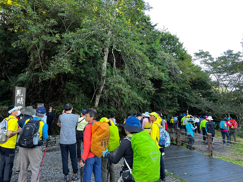
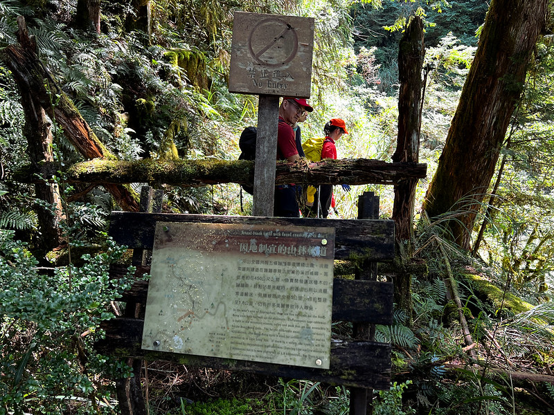
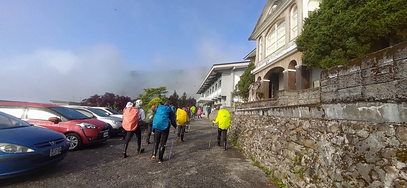
07:25 We arrived at the trailhead of Jancing Historic Trail.
The first highlight starts even before the hike. When you arrive at the trailhead of Jancing Historic Trail, please stop at this sign to take a look. You will see all the famous mountains from Xueshan Range (Snow Mountain Range), like Mt. Dabajian and Mt. Xiaobajian, Mt. Pingtian, and of course, Snow Mountain.

As expected, many tourists and hikers arrived at the trailhead.
07:43 We walked on the railway tracks used to transport logs in the old days.
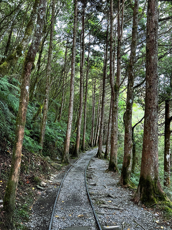
This trail is well-marked; you can follow the marked signs and enjoy strolling.

Soon, we arrived at the old tracks covered by ferns.
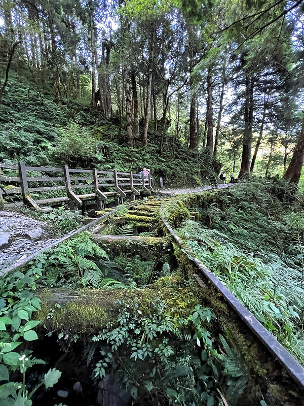
Our guides let us take our time to enjoy this section. I was here in 2018 but visiting here again is still fascinating.

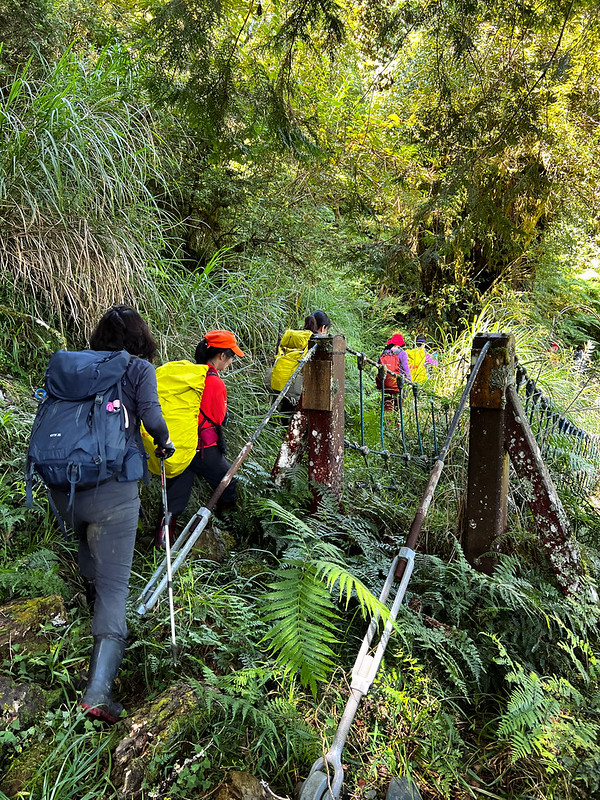
Many old tracks were hanging in the air. For safety reasons, small suspension bridges were built to replace those passages.
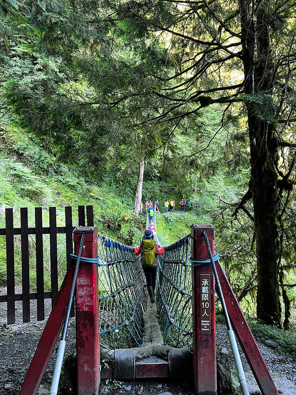
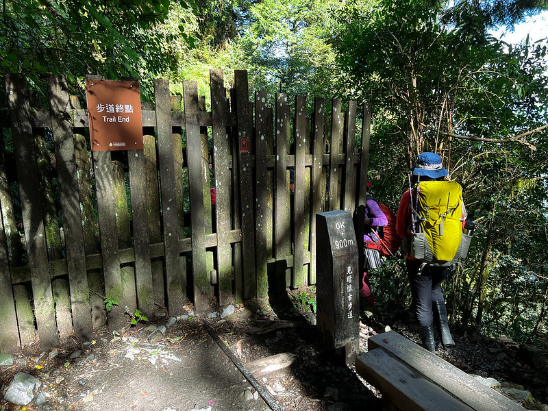
08:22 We reached the end of the trail at 900 meters. It's a shame that this beautiful trail is so short. But You have to take the same way back to the trailhead and enjoy the rest of Taipingshan.
Exploring Taiwan? Save Time with the Ultimate 2025 Hiking Guide! Discover the top hikes in every city and county across Taiwan—all accessible by public transport (bus links available). We've spent 50+ hours researching the best trails and transit options, so you can skip the hassle and start your adventure!
Uncover Taiwan's hidden gems - hotels, restaurants, transport, and more — on 
Beyond Jancing and Hike Part of Taipingshan-Jialuo Lake Trail
Trail Name: From Jancing Historic Trail, Mt. Duomen, to Taipingshan
Distance: 15.4 km (9.6 miles)
Route type: Point to point. If you park your car at the parking lot near the trailhead of Jancing Historic Trail, you can hike about 2km from Taipingshan to retrieve your vehicle and make this a loop hike.
Days/Hours Needed: 8 - 10 hours
Total Ascent/Descent: 766m/780m
Best Time to Go: All year round
Permits: Required
Difficulty Level:
Peaks to Reach: Mt. 多門山, 2,273 meters (7,457 feet) above sea level. No views at the peak.

Additional Information:
- Hikers need to apply for police entry permits to do this hike.
- This hike is more treacherous and physically demanding. NOT FOR TOURISTS.
- The trail terrains are muddy and slippery.
- The weather in the Taiwan mountains often turns gloomy around noon. So, if you want to enjoy a beautiful day, please get to the trails as early as possible.
- Read my Jialuo Lake Trail post about how to hike Taipingshan and Jialuo Lake Trail.
Brief itinerary: Trailhead of Jancing Historic Trail ➔ 0.9 km return point ➔ junction to Mt. Duomen ➔ Mt. Duomen ➔ return to junction ➔ entrance to Taipingshan-Jialuo Lake Trail/end of Chinese Hemlock Trail/lookout ➔ Jhenan Temple ➔ Taipingshan Villa
(Continued from the previous Jancing Historic Trail)
After we passed the gate at 0.9 km, it felt like we had entered a different world than Jancing Historic Trail. The untouched nature replaced the well-kept trail.
After we passed the gate at 0.9 km, it felt like we had entered a different world than Jancing Historic Trail. The untouched nature replaced the well-kept trail.

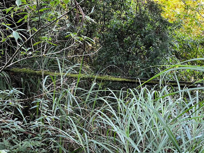
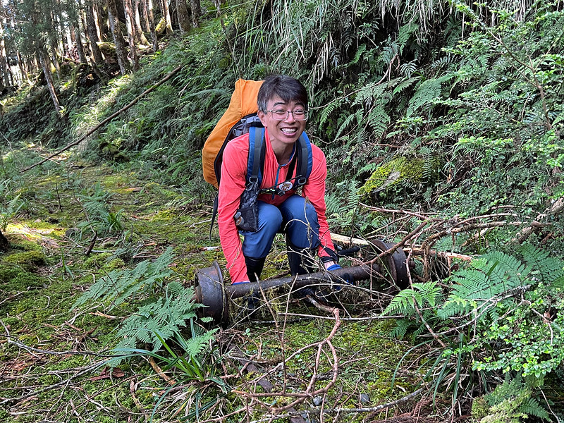
The railway tracks and machinery left behind by the logging stations were the giveaways of the human traces.
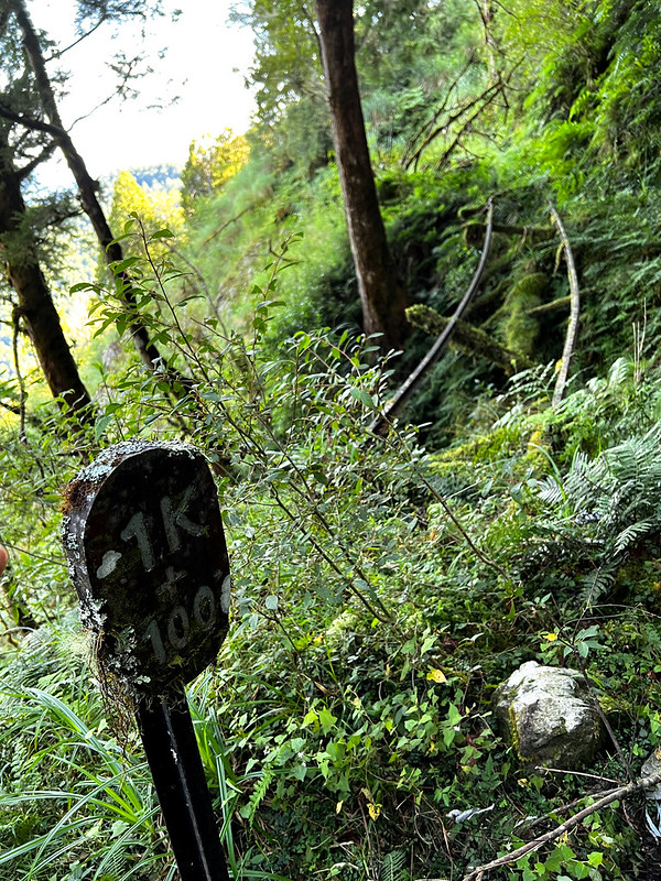
08:56 We passed the tilting post written 1K+100.
We bypassed a suspension bridge that resembled those we saw earlier on Jancing Historic Trail.
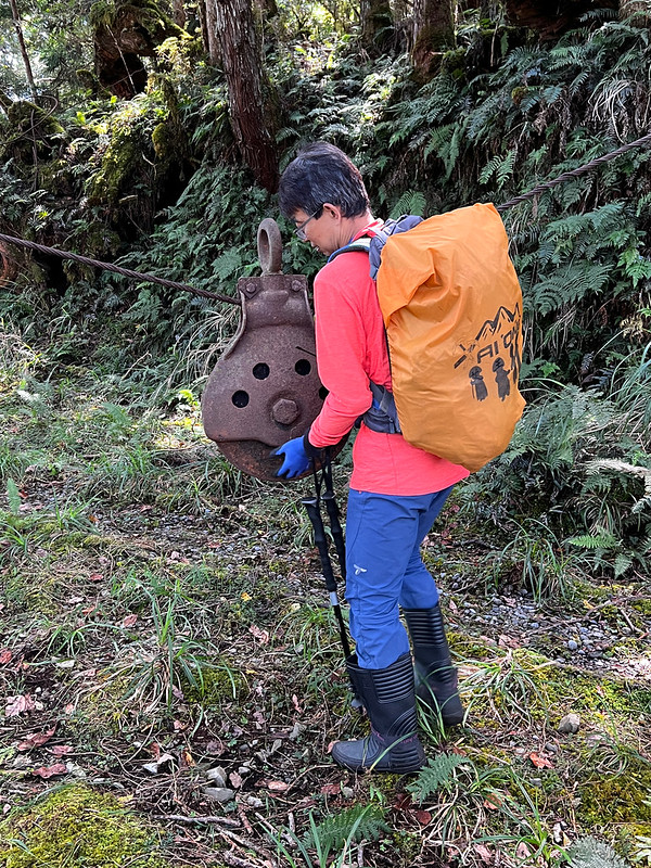
09:36 We saw a huge hanger-like gadget. You can see how big it was when our guide Mingshu stood next to it. I have no knowledge about railways. If you know what that is, please kindly let me know.
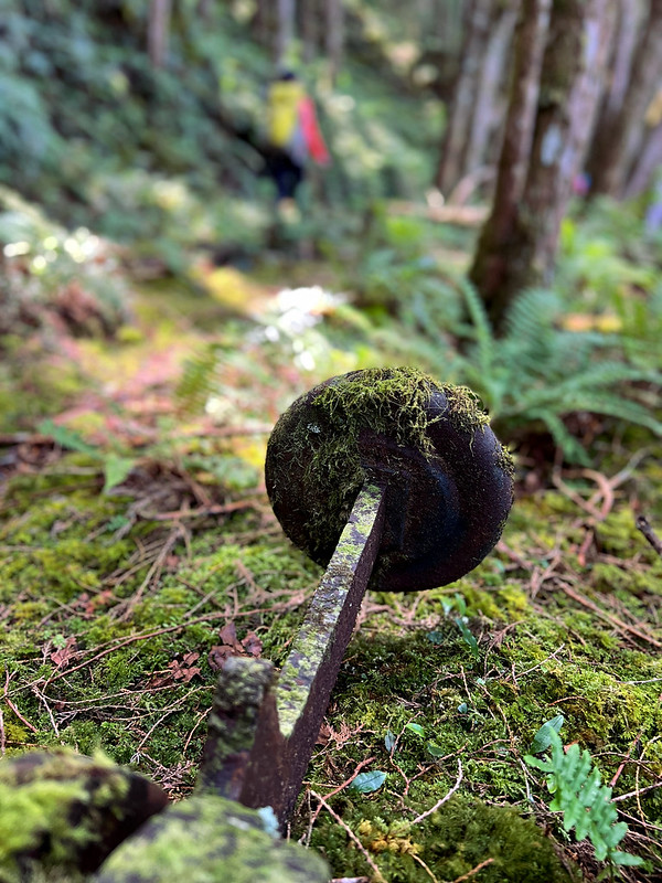
We reached a flat and easy-to-hike section, and we saw more machinery like switches and other things that I didn't even know.
09:48 We saw a structure that looked like a station. We guessed it was the stop of the Bong Bong train (the railway to transport logs). The sign was another giveaway proving this section was open to tourists before.
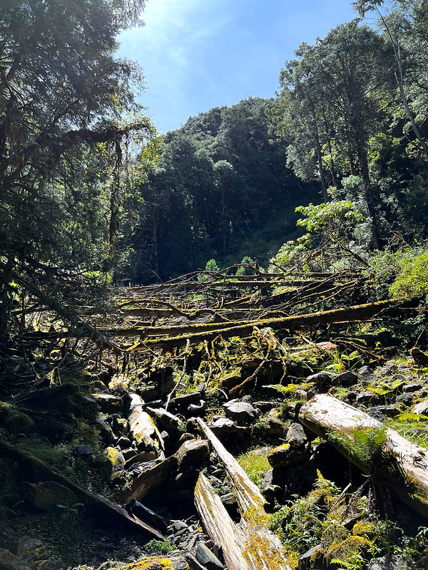
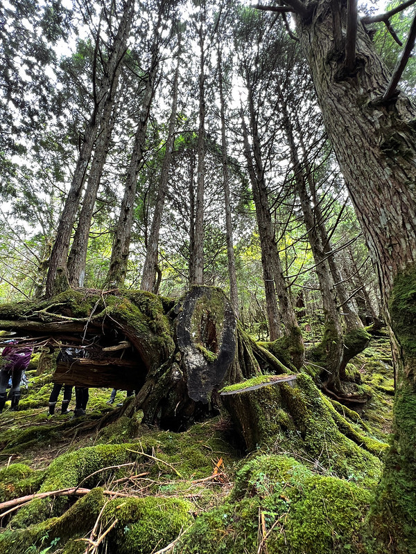
10:08 We went down to a valley with massive logs lying there. This valley looked like a dried riverbed, but I am not sure.
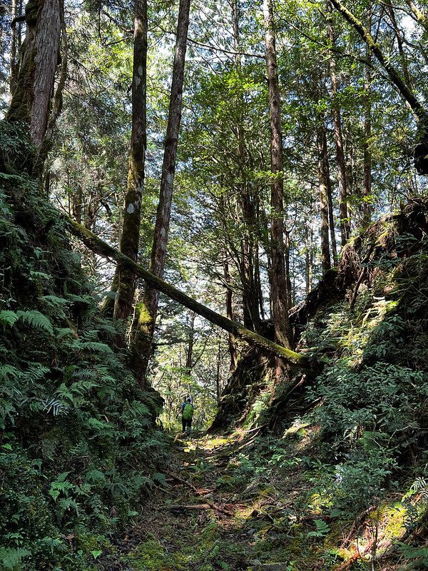
We went up to the railway track again. Again, the sunshine cast its warm glow in the woods.
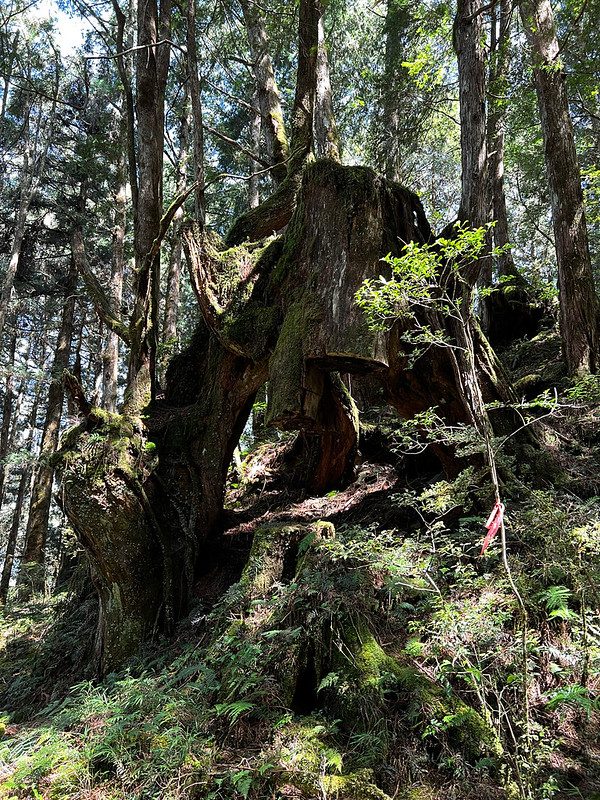
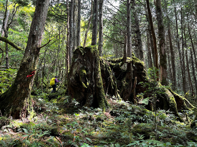
More relics lay on the tracks; more gigantic tree roots were left without the thick tree trunks that were once almost tall enough to touch the sky.
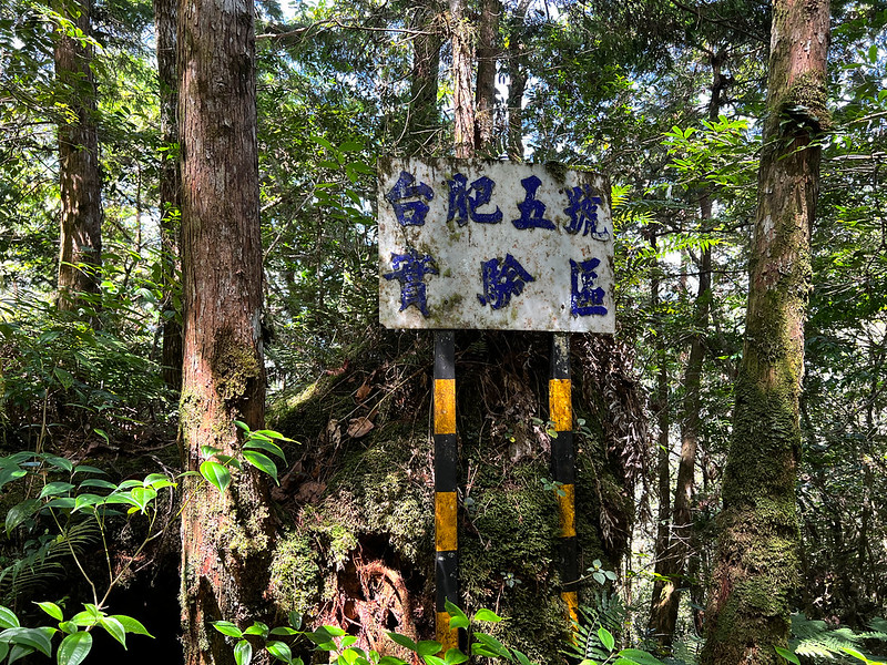
11:05 We reached a place with a sign saying Taiwan Fertilizer No. 5 Experiment Area 台肥5號實驗區. I guess Taiwan Fertilizer Co. tested their products here before.
After the lunch break, we left the track and went uphill. By now, the sunny weather was gone. Instead, it turned into the typical Yilan weather, gloomy and gray.
We saw many huge tree roots here, too, but the difference is many thinner tree trunks grew from those big roots and shot in the air.
13:13 We reached a junction. My map said there was a Kuimu Campgrount 檜林營地 here, but I can't tell. From here to Mt. Duomen's direction, this trail belongs to the Taipingshan-Jialuo Lake trail.

13:26 We reached Mt. Duomen, 2,273 meters. There is no view from the triangulation stone.

14:50 I reached the trailhead to Jialuo Lake with the elevation of 1,300m. There is a big sign telling hikers how the marking system works. This sign is a well-made billboard with details, but the only problem is it's only in Chinese.
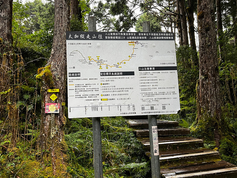
If you take the trail to Jialuo Lake, you will see the numbered marks every 100 meters and yellow marks to show you the way. Taipingshan-Jiuluo Lake Trail starts from this point to the big old tree trailhead, and the distance is 10.7 km.
There is a lookout around here. If the weather is good, you can see Snow Mountain, Mt. Dabajian, and other mountains, but it rained before I reached here, which is a typical weather pattern in Yilan, Taiwan.
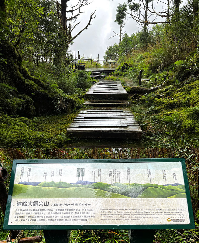
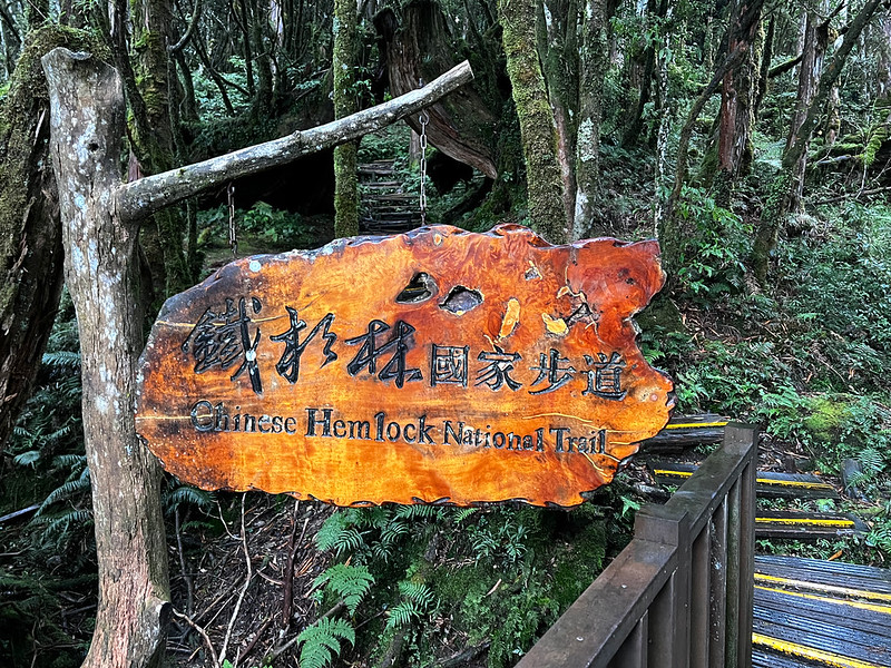
This lookout is also the destination of the Chinese Hemlock National Trail. Tourists have to take the same way back to Taipingshan.
Chinese Hemlock Trail and Taipingshan, Plus Trail Information
Trail Name: Chinese Hemlock Trail
Distance: 2.6km (1.6 miles)
Route type: Out and back
Days/Hours Needed: 2 hours, but I'm sure you will spend more than one hour enjoying this beautiful trail.
Total Ascent/Descent: 224m/224m
Best Time to Go: All year round
Permits: Not required
Difficulty Level:
Distance: 2.6km (1.6 miles)
Route type: Out and back
Days/Hours Needed: 2 hours, but I'm sure you will spend more than one hour enjoying this beautiful trail.
Total Ascent/Descent: 224m/224m
Best Time to Go: All year round
Permits: Not required
Difficulty Level:
(After passing the lookout near the starting point of Taipingshan-Jiuluo Lake Trail)
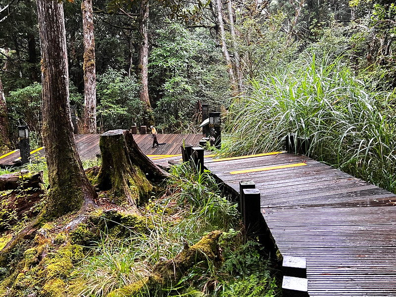
15:18 I reached the trailhead of the Chinese Hemlock National Trail.
15:18 I reached the trailhead of the Chinese Hemlock National Trail.
I don't like to walk on the plank steps in the rain because it's so slippery. But Taipingshan has done an excellent job by putting anti-slippery tapes on the steps.

I was alone in this section, and not many people were around. Then, suddenly, I saw something about 5 meters ahead of me. It's Formosan Yellow-throated Marten 黃喉貂.
I managed to snap this photo before it disappeared. Formosan Yellow-throated Martens look cute, but they are the worst nightmare for Reeves's muntjacs. Yellow-throated Martens hunt a muntjac in groups and attack the lone muntjac from the rear end. You get the idea.
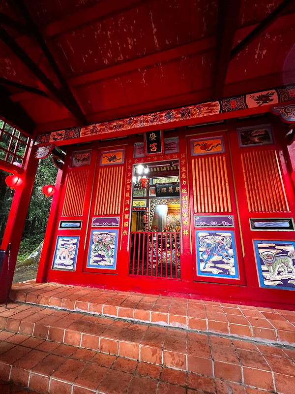
15:27 I reached Jhenan Temple 鎮安宮. By the time I arrived at this temple, it had rained hard. So, I didn't stay long.
15:40 Arrived at the parking lot. There are toilets near the parking lot. Finally, we called it a day.
Last but Not Least: Wildflowers

For more wildflowers I saw on the trails, please check out my Flowers on the Trails page.
How to Get There and Apply for Permits If You Hike Beyond
Take Kingbus 1750A (for the weekdays) or 1750 (for the weekends) from Yilan Transfer Station and get off at the trailhead of Jancing Historic Trail. This bus also goes to Taipingshan. So, you can take the same bus back to Yilan after this hike.
Bus fare (one way): NT$243
Bus travel time: 2.5 hours
From Yilan Transfer Station to Taipingshan: 7:40
From Taipingshan to Yilan Transfer Station: 14:30
Bus travel time: 2.5 hours
From Yilan Transfer Station to Taipingshan: 7:40
From Taipingshan to Yilan Transfer Station: 14:30
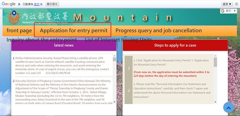
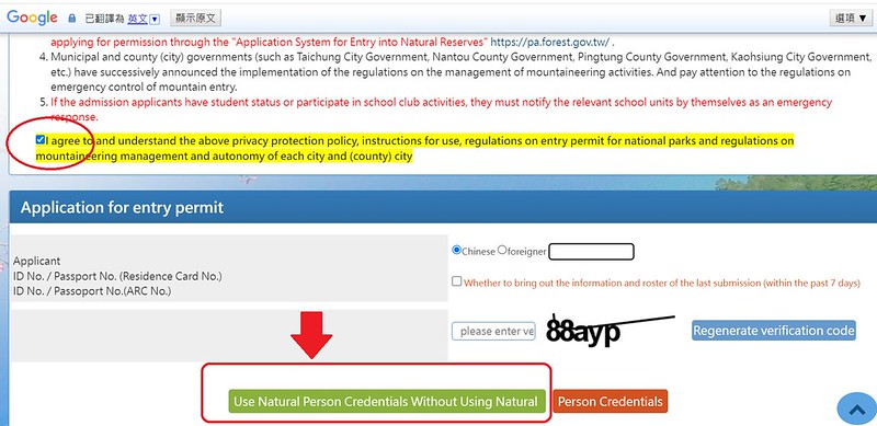
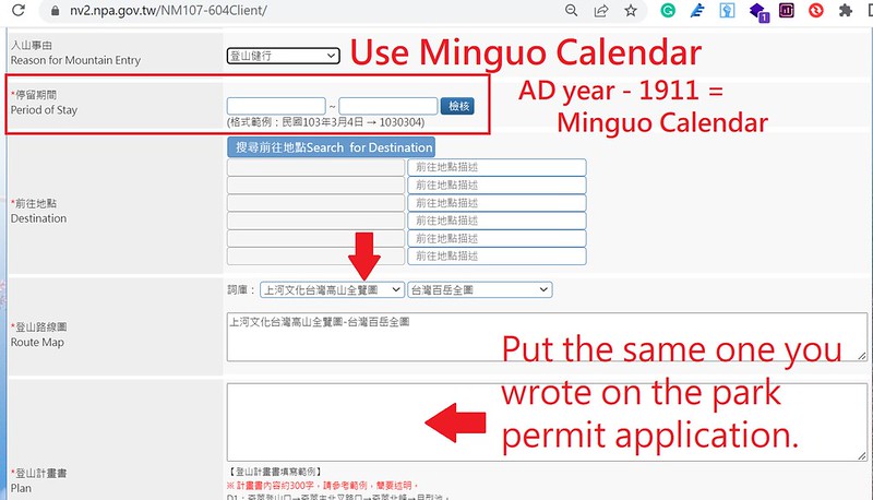
Apply for Police Entry Permits
Click here to apply for Police Entry Permits.

Map/GPX Data
You can see the trails I did at Taipingshan and Dayuanshan (Mt. Dayuan and Dayuan Elementary School.)
Click Menu in the map to download, print, or share the map.
You can see more options after clicking the Play button.
Click to change the speed to meet your condition.
You can see more options after clicking the Play button.
Click
to change the speed to meet your condition.
About Taipingshan Logging History
Taipingshan used to be called Minnao 眠腦 by the indigenous Atayal people, which means lush forest. It's in Datong County, Yilan, at an elevation between 500 to 2,000 meters above sea level.

Taipingshan faces the Pacific Ocean and is flanked by the Xueshan Mountain Range and the Central Mountain Range. The average temperature is 13°C with a humidity of 85%.
This area is excellent for precious woods like Benihi 紅檜 and Hinoki 扁柏 to grow. During the Japanese Occupation, Taipingshan became one of the major logging stations in Taiwan, exporting tons of precious wood overseas.
In the 1980s, Taiwan changed its logging policy and banned commercial logging. As a result, Taipingshan went from a cash machine to a tourist attraction, education center, and preservation area with a whole new look.
Taipingshan and Dayuanshan (Mt. Dayuan)
I did a hike to Mt. Dayuan and Dayuan Elementary School in February 2022, and I put several paragraphs about the logging history at Mt. Dayuan and Taipinghsan.

Regarding log production, Mt. Dayuan Logging Station produced more logging volume than Taipingshan Logging Station. Dayuanshan and Taipingshan shared a crucial position in contributing to Taiwan's economy.

However, the history of Taipingshan is better preserved, and Taipingshan has transformed into a popular tourist attraction.
You can click my post to Mt. Dayuan for more history about the logging industry in Taiwan.
Get Free Guides on Public Transport and Applying for Permits. Or Hire Me!
Free Bus Guides to Hike Popular Mountains in Taiwan
Taking buses to hike in Taiwan can be tricky if you don't read Chinese. Therefore, I've made several public transport guides to help you get to the trailheads. Or click the image below to see more details.

Hike Consultation: Simplify Your Taiwan Hike with Our Services
Tackling the intricacies of permit applications and deciphering public transport routes in Taiwan can be daunting. We're here to make your hiking adventure hassle-free.
Our service takes care of all the nitty-gritty details, from permit applications to transportation arrangements, weather reminders, and more. Let us handle the complexities, so you can focus on the breathtaking trails and unforgettable experiences. Visit our commission page or click the button below for all the details.
I hope you enjoy this post. Have you done Jancing Historic or Taipinghsan-Jialuo Lake Trail? Are you planning to do it? Feel free to let me know in the comments below.